 Tweet
Tweet
What's the ETA for it to hit?
-
We the people are the rightful masters of both Congress and the courts, not to overthrow the Constitution but to overthrow the men who pervert the Constitution. - Abraham Lincoln -
LA and Long Beach carry the most volume, but the loss of that port is definitley a huge blow. On top of that, the current energy crisis is only going to get worse:Originally posted by Dr Strangelove
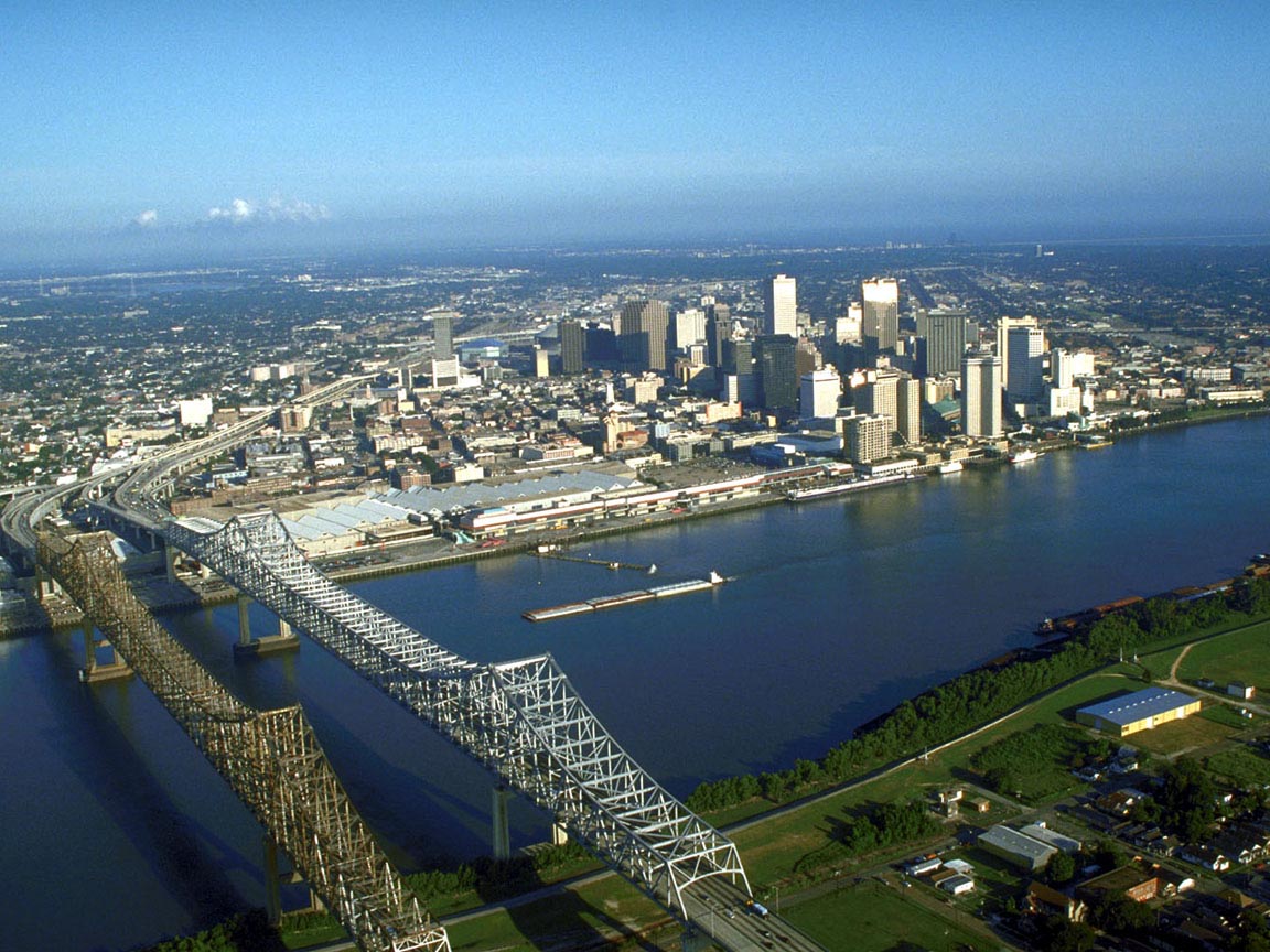
May I point out that New Orleans is the United State's largest port? If the port of New Orleans is severely damaged it will affect the entire economy.
U.S. energy companies said U.S. Gulf of Mexico crude oil output was cut by more than one-third on Saturday because of the threatening storm, Reuters reported.
The Gulf of Mexico is home to roughly a quarter of U.S. domestic oil and gas output, with a capacity to produce about 1.5 million barrels per day of crude and 12.3 billion cubic feet per day of gas. (Full story)
Many oil platforms and rigs in the Gulf of Mexico have been evacuated. ((Watch the video of drilling crews securing rigs and seeking safety.)We the people are the rightful masters of both Congress and the courts, not to overthrow the Constitution but to overthrow the men who pervert the Constitution. - Abraham LincolnComment
-
Hurricane Katrina 4th Strongest Atlantic Hurricane
8/28/2005 8:16 p.m. ET
Hurricane Katrina is now a Category 5 hurricane -- top winds are 160 mph. The pressure has dropped as low as 904 mb. This pressure reading is the 4th lowest on record in the Atlantic Basin.
**********************************
Early in the morning, Monday, is all I'm seeing.
How early is early?
Moving at 7 mph, but can't see how far out it's located currently.

Seen from the shores of Madeira Beach, the sun sets behind the edge of powerful Hurricane Katrina
Last edited by SlowwHand; August 28, 2005, 20:44.Life is not measured by the number of breaths you take, but by the moments that take your breath away.
"Hating America is something best left to Mobius. He is an expert Yank hater.
He also hates Texans and Australians, he does diversify." ~ BraindeadComment
-
-
Jefferson County (on the Southern tip of Louisiana) is empty except for 7 die-hards who refused to leave. The county's emergency ops director was essentially referring to them in the past tense on the news report...Tutto nel mondo è burlaComment
-
Any news on how the evacuation is proceeding? "I have been reading up on the universe and have come to the conclusion that the universe is a good thing." -- Dissident
"I never had the need to have a boner." -- Dissident
"I have never cut off my penis when I was upset over a girl." -- DisComment
-
Actually it's there, in looking at that satellite from Jonny.
Maybe not to New Orleans, and maybe not the worst, but it's there.Life is not measured by the number of breaths you take, but by the moments that take your breath away.
"Hating America is something best left to Mobius. He is an expert Yank hater.
He also hates Texans and Australians, he does diversify." ~ BraindeadComment
-
Keep in mind that that satellite loop is about 1 hour behind current time...
Let's hope that things don't look much different than they do now when this thing is over:
Comment
-
Where did you find that? Link?Originally posted by ixnay
HURRICANE KATRINA
A MOST POWERFUL HURRICANE WITH UNPRECEDENTED
STRENGTH...RIVALING THE INTENSITY OF HURRICANE CAMILLE OF 1969.
MOST OF THE AREA WILL BE UNINHABITABLE FOR WEEKS...PERHAPS LONGER. AT
LEAST ONE HALF OF WELL CONSTRUCTED HOMES WILL HAVE ROOF AND WALL
FAILURE. ALL GABLED ROOFS WILL FAIL...LEAVING THOSE HOMES SEVERELY
DAMAGED OR DESTROYED.
THE MAJORITY OF INDUSTRIAL BUILDINGS WILL BECOME NON FUNCTIONAL.
PARTIAL TO COMPLETE WALL AND ROOF FAILURE IS EXPECTED. ALL WOOD
FRAMED LOW RISING APARTMENT BUILDINGS WILL BE DESTROYED. CONCRETE
BLOCK LOW RISE APARTMENTS WILL SUSTAIN MAJOR DAMAGE...INCLUDING SOME
WALL AND ROOF FAILURE.
HIGH RISE OFFICE AND APARTMENT BUILDINGS WILL SWAY DANGEROUSLY...A
FEW TO THE POINT OF TOTAL COLLAPSE. ALL WINDOWS WILL BLOW OUT.
AIRBORNE DEBRIS WILL BE WIDESPREAD...AND MAY INCLUDE HEAVY ITEMS SUCH
AS HOUSEHOLD APPLIANCES AND EVEN LIGHT VEHICLES. SPORT UTILITY
VEHICLES AND LIGHT TRUCKS WILL BE MOVED. THE BLOWN DEBRIS WILL CREATE
ADDITIONAL DESTRUCTION. PERSONS...PETS...AND LIVESTOCK EXPOSED TO THE
WINDS WILL FACE CERTAIN DEATH IF STRUCK.
POWER OUTAGES WILL LAST FOR WEEKS...AS MOST POWER POLES WILL BE DOWN
AND TRANSFORMERS DESTROYED. WATER SHORTAGES WILL MAKE HUMAN SUFFERING
INCREDIBLE BY MODERN STANDARDS.
THE VAST MAJORITY OF NATIVE TREES WILL BE SNAPPED OR UPROOTED. ONLY
THE HEARTIEST WILL REMAIN STANDING...BUT BE TOTALLY DEFOLIATED. FEW
CROPS WILL REMAIN. LIVESTOCK LEFT EXPOSED TO THE WINDS WILL BE
KILLED.
AN INLAND HURRICANE WIND WARNING IS ISSUED WHEN SUSTAINED WINDS NEAR
HURRICANE FORCE...OR FREQUENT GUSTS AT OR ABOVE HURRICANE FORCE...ARE
CERTAIN WITHIN THE NEXT 12 TO 24 HOURS.
ONCE TROPICAL STORM AND HURRICANE FORCE WINDS ONSET...DO NOT VENTURE
OUTSIDE!
Sounds like fun!Captain of Team Apolyton - ISDG 2012
When I was younger I thought curfews were silly, but now as the daughter of a young woman, I appreciate them. - RahComment
-
I find it ironic that people are saying things like "god help them", considering stuff like this is usually called an 'Act of god'...")
Anyone ever seen The Man Who Sued god? Great movie about the hypocrisy of believing in god...
All we can do is hope that somehow the storm loses a bit of strength and changes course a bit through the least populated area in its path...Comment
-
The national weather service, actuallyOriginally posted by OzzyKP
Where did you find that? Link?
Comment
-
Captain of Team Apolyton - ISDG 2012
When I was younger I thought curfews were silly, but now as the daughter of a young woman, I appreciate them. - RahComment
-
Last report I heard said 10,000 will be braving it out at the Superdome."I predict your ignore will rival Ben's" - Ecofarm
^ The Poly equivalent of:
"I hope you can see this 'cause I'm [flipping you off] as hard as I can" - Ignignokt the MooniniteComment
-
The live feeds coming out of New Orleans on CNN are amazing.
Why the hell are there still cars driving INTO the city?"I predict your ignore will rival Ben's" - Ecofarm
^ The Poly equivalent of:
"I hope you can see this 'cause I'm [flipping you off] as hard as I can" - Ignignokt the MooniniteComment
-
From the AP:
A guy on CNN, Ivor Van Heerden, of the LSU Public Health Research Center, said this could be USA's Tsunami...When Hurricane Katrina hits New Orleans on Monday, it could turn one of America's most charming cities into a vast cesspool tainted with toxic chemicals, human waste and even coffins released by floodwaters from the city's legendary cemeteries.
Experts have warned for years that the levees and pumps that usually keep New Orleans dry have no chance against a direct hit by a Category 5 storm.
That's exactly what Katrina was as it churned toward the city. With top winds of 165 mph and the power to lift sea level by as much as 28 feet above normal, the storm threatened an environmental disaster of biblical proportions, one that could leave more than 1 million people homeless.
"All indications are that this is absolutely worst-case scenario," Ivor van Heerden, deputy director of the Louisiana State University Hurricane Center, said Sunday afternoon.
The center's latest computer simulations indicate that by Tuesday, vast swaths of New Orleans could be under water up to 30 feet deep. In the French Quarter, the water could reach 20 feet, easily submerging the district's iconic cast-iron balconies and bars.
Estimates predict that 60 percent to 80 percent of the city's houses will be destroyed by wind. With the flood damage, most of the people who live in and around New Orleans could be homeless.
"We're talking about in essence having _ in the continental United States _ having a refugee camp of a million people," van Heerden said.
Aside from Hurricane Andrew, which struck Miami in 1992, forecasters have no experience with Category 5 hurricanes hitting densely populated areas.
"Hurricanes rarely sustain such extreme winds for much time. However we see no obvious large-scale effects to cause a substantial weakening the system and it is expected that the hurricane will be of Category 4 or 5 intensity when it reaches the coast," National Hurricane Center meteorologist Richard Pasch said.
As they raced to put meteorological instruments in Katrina's path Sunday, wind engineers had little idea what their equipment would record.
"We haven't seen something this big since we started the program," said Kurt Gurley, a University of Florida engineering professor. He works for the Florida Coastal Monitoring Program, which is in its seventh year of making detailed measurements of hurricane wind conditions using a set of mobile weather stations.
Experts have warned about New Orleans' vulnerability for years, chiefly because Louisiana has lost more than a million acres of coastal wetlands in the past seven decades. The vast patchwork of swamps and bayous south of the city serves as a buffer, partially absorbing the surge of water that a hurricane pushes ashore.
Experts have also warned that the ring of high levees around New Orleans, designed to protect the city from floodwaters coming down the Mississippi, will only make things worse in a powerful hurricane. Katrina is expected to push a 28-foot storm surge against the levees. Even if they hold, water will pour over their tops and begin filling the city as if it were a sinking canoe.
After the storm passes, the water will have nowhere to go.
In a few days, van Heerden predicts, emergency management officials are going to be wondering how to handle a giant stagnant pond contaminated with building debris, coffins, sewage and other hazardous materials.
"We're talking about an incredible environmental disaster," van Heerden said.
He puts much of the blame for New Orleans' dire situation on the very levee system that is designed to protect southern Louisiana from Mississippi River floods.
Before the levees were built, the river would top its banks during floods and wash through a maze of bayous and swamps, dropping fine- grained silt that nourished plants and kept the land just above sea level.
The levees "have literally starved our wetlands to death" by directing all of that precious silt out into the Gulf of Mexico, van Heerden said.
It has been 40 years since New Orleans faced a hurricane even comparable to Katrina. In 1965, Hurricane Betsy, a Category 3 storm, submerged some parts of the city to a depth of seven feet.
Since then, the Big Easy has had nothing but near misses. In 1998, Hurricane Georges headed straight for New Orleans, then swerved at the last minute to strike Mississippi and Alabama. Hurricane Lili blew herself out at the mouth of the Mississippi in 2002. And last year's Hurricane Ivan obligingly curved to the east as it came ashore, barely grazing a grateful city."I predict your ignore will rival Ben's" - Ecofarm
^ The Poly equivalent of:
"I hope you can see this 'cause I'm [flipping you off] as hard as I can" - Ignignokt the MooniniteComment


Comment