Announcement

Collapse
No announcement yet.

Operation: Downfall

Collapse
X
 
  • Filter
  • Time
  • Show
Clear All
new posts

  • #31
    Pleanty of time to think things through and make a solid plan before starting this one. Best to factor everything in from the word go than get well into the design and realise you have forgotten one key factor!

    I agree with Boco that broadening the scale of the game too far would eat into the events space.
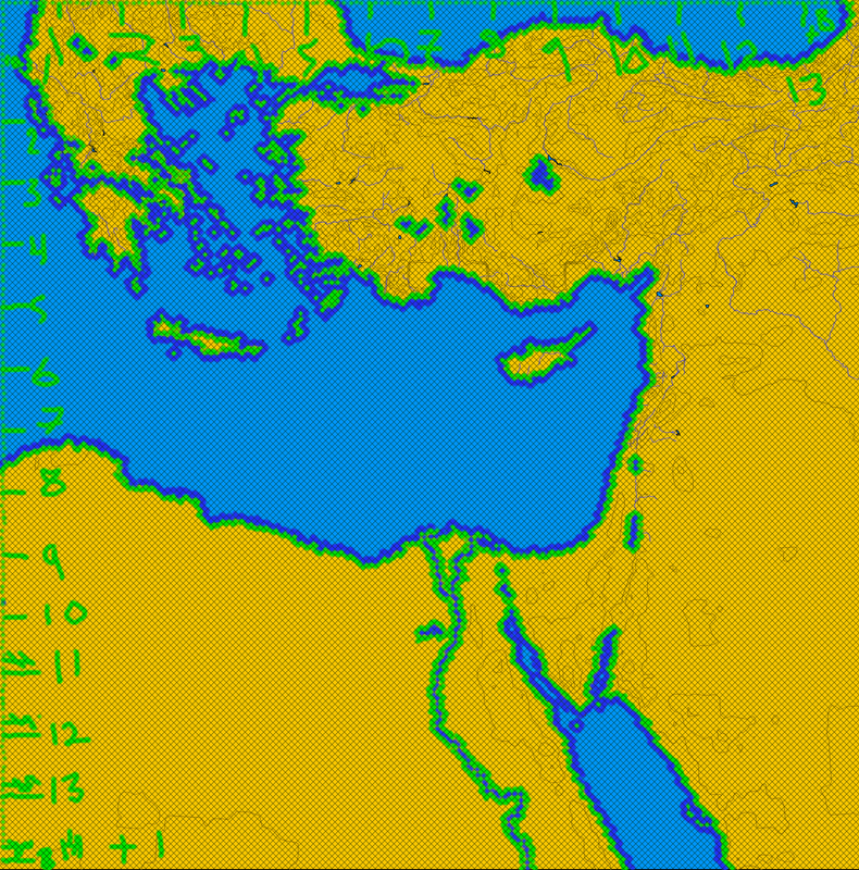
    AFAIK the projected date for Operation Olympic was 1st November 1945. The Russians had captured Southern Sakhalin and the Kurile Islands by 1st September 1945 so that campaign would not need to be covered. From Sakhalin a Soviet invasion of Hokkaido would be much easier to represent.

    The problem is Korea. Had the Japanese not surrendered and the war had continued would the Soviet tank columns have stopped at the 38th parallel? I think it would be highly unlikely. If this was part of the premise then I think it would be acceptable to assume that the USSR had occupied the entire Korean peninsula by November 1945 and could therefore be in possesion of Pusan and in a possition to launch some sort of ad hoc invasion of Kyushu or Honshu!

    If you explained all this in the introduction I think it would sound plausable as alternative history.

    I dig Agricolas seaweed and suicide squad appraisal. Lots ok Kamikaze (missile) planes and suicide tank killers would fit the bill!

    The devinde wind Well it worked for the Japanes once but the Mongols were in a shoddy fleet of Chinese river barges by all accounts. I think the original concept of a US vs Japan battle would be interesting up to a point in the game but the potential for WWIII between all three nations sounds like the stuff of an alternative history epic!

    One day I will work out how to write a concise reply
    SCENARIO LEAGUE FORUM
    SCENARIO LEAGUE WIKI SITE
    SL INFORMATION THREAD
    CIV WEBRING MULTIPLAYER FORUM

    Comment


    • #32
      Originally posted by Boco
      If you work from the premise that the a-bomb was not a viable weapon, the scenario could make sense. Then it could either focus on Japan's Götterdämerung or make that a prelude to a Bear vs Eagle showdown in the Far East.
      My divergence of choice is the sinking of the Indianapolis before it delivers the first bomb to Tinian. It might have occurred had McVay followed standard antisub procedures and not broken speed records across the Pacific.
      "You give a guy a crown and it goes straight to his head."
      -OOTS

      Comment


      • #33
        Originally posted by curtsibling Perhaps some calamity happens to the US forces as they land?

        *Typhoon strikes as the US forces try to land?
        Actually, I heard somewhere that had the date for Operation Coronet been kept, there was a large typhoon that did in fact come by that area in real life.

        Maybe this was the "divine wind"/kamikaze that would have saved Japan?

        Caveat Lector: can't seem to find on the net anywhere proof that I typhoon did in fact occur during one of the Coronet landing dates, so that may or may not be true...
        Georgi Nikolai Anzyakov, Commander Grand Northern Front, Red Front Democracy Game

        Comment


        • #34
          Originally posted by The ANZAC


          Actually, I heard somewhere that had the date for Operation Coronet been kept, there was a large typhoon that did in fact come by that area in real life.

          Maybe this was the "divine wind"/kamikaze that would have saved Japan?

          Caveat Lector: can't seem to find on the net anywhere proof that I typhoon did in fact occur during one of the Coronet landing dates, so that may or may not be true...
          You are correct regarding the Typhoon. I read about it once in the US official army history.

          It stated that a Typhoon did in fact strike the area at about the time of the planned invasion. It struck during the time when the invasion ships/troops would have been positioning themselves for the actual assault!

          Imagine the casualties among the US troops.

          Fact is often stranger than fiction....

          Comment


          • #35
            Here is a quote from an article:


            "The Divine Wind, or Kamikaze, of a powerful typhoon destroyed a foreign invasion force heading for Japan in 1281, and it was for this storm that Japanese suicide aircraft of World War II were named. On October 9, 1945, a similar typhoon packing 140-mile per hour winds struck the American staging area on Okinawa that would have been expanded to capacity by that time if the war had not ended in September, and was still crammed with aircraft and assault shipping- much of which was destroyed. US analysts at the scene matter-of-factly reported that the storm would have caused up to a 45-day delay in the invasion of Kyushu. The point that goes begging, however, is that while these reports from the Pacific were correct in themselves, they did not make note of the critical significance that such a delay, well past the initial- and unacceptable- target date of December 1, would have on base construction on Kyushu, and consequently mean for the Honshu invasion, which would have then been pushed back as far as mid-April 1946.

            "If there had been no atom bombs and Tokyo had attempted to hold out for an extended time- a possibility that even bombing and blockade advocates granted- the Japanese would have immediately appreciated the impact of the storm in the waters around Okinawa. Moreover, they would know exactly what it meant for the follow-up invasion of Honshu, which they had predicted as accurately as the invasion of Kyushu. Even with the storm delay and friction of combat on Kyushu, the Coronet schedule would have led US engineers to perform virtual miracles to make up for lost time and implement Y-Day as early in April as possible. Unfortunately the Divine Winds packed a one-two punch.

            "On 4 April 1946, another typhoon raged in the Pacific, this one striking the northernmost Philippine island of Luzon on the following day where it inflicted only moderate damage before moving toward Taiwan. Coming almost a year after the war, it was of no particular concern. The Los Angeles Times gave it about a paragraph on the bottom of page 2. But if Japan had held out, this storm would have had profound effects on the world we live in today. It would have been the closest watched weather cell in history. Would the storm move to the west after hitting Luzon, the Army's main staging area for Coronet, or would it take the normal spiraling turn to the north, and then northeast as the October typhoon? Would slow, shallow-draft landing craft be caught at sea or in the Philippines where loading operations would be put on hold? If they were already on their way to Japan, would they be able to reach Kyushu's sheltered bay? And what about the breakwater caissons for the massive artificial harbor to be assembled near Tokyo? The construction of the harbor's pre-fabricated components carried a priority second only to the atom bomb, and this precious towed cargo could not be allowed to fall victim to the storm and be scattered across the sea."

            Transcript of "OPERATION DOWNFALL [US invasion of Japan]: US PLANS AND JAPANESE COUNTER-MEASURES" by D. M. Giangreco, US Army Command and General Staff College, 16 February 1998:

            Comment


            • #36
              1st Map update

              Here is a very early progress report. Basically the architects have completed their draughts, the surveyors have measured up and the scaffolding has been erected

              I always find this early stage very strange as the map looks tiny, it is only when you fill it in that you realise how big it really is.
              This time things are progressing faster as I have a few new time saving tricks (including swapping hands over!?!). The tricky bit is getting the measurements correct but I think I got lucky and it worked right first time

              P.s. each small square is 4x4sq, the large ones are 10x10sq, not sure how that works out but it does!
              Attached Files
              SCENARIO LEAGUE FORUM
              SCENARIO LEAGUE WIKI SITE
              SL INFORMATION THREAD
              CIV WEBRING MULTIPLAYER FORUM

              Comment


              • #37
                Scale

                Patine
                I have just started adding the first of the islands and I wanted to ask your opinion. The scale is a bit smaller than the map Darth Vader made but of course it includes Hokkaido, Korea and parts of Manchuria and SE Siberia.

                It seems to be a good scale still. I will post a closeup of Shikoku below and as you will be able to see you could fit in 10-12 cities on that island alone without overlapping.

                Just wanted to know if this will be big enough for what you have in mind as I do not want to have to start again later. I suppose the real question is do you want a straight US vs JPN scenario or one that has the potential to include the USSR? (which I would still vote for!)
                Attached Files
                SCENARIO LEAGUE FORUM
                SCENARIO LEAGUE WIKI SITE
                SL INFORMATION THREAD
                CIV WEBRING MULTIPLAYER FORUM

                Comment


                • #38
                  And the close up of Western Shikoku.
                  Attached Files
                  SCENARIO LEAGUE FORUM
                  SCENARIO LEAGUE WIKI SITE
                  SL INFORMATION THREAD
                  CIV WEBRING MULTIPLAYER FORUM

                  Comment


                  • #39
                    Looks good so far. I'd like the Soviet idea to be an option, so please carry on as your doing. It's easier to prune than add to an existing map. Thanks!

                    Comment


                    • #40
                      Werd100, do you stretch your bitmaps in the x direction before you start?
                      El Aurens v2 Beta!

                      Comment


                      • #41
                        @Patine
                        Cool. I have just added most of Kyushu and that looks ok also. Obviously Honshu is about eight times the size so I think I will be surprised myself by how big it actually is. I just tend to panic a bit when I first start

                        @Boco
                        I'm afraid I don't follow Which bitmap? Which x direction? Sorry for being a bit thick!
                        SCENARIO LEAGUE FORUM
                        SCENARIO LEAGUE WIKI SITE
                        SL INFORMATION THREAD
                        CIV WEBRING MULTIPLAYER FORUM

                        Comment


                        • #42
                          I learned it myself at Catfish's Cave.


                          Originally written by Catfish

                          The map: below is a zoomed out in-game shot (reduced 50%) of my 32 725-tile gigamap of Middle-earth. I'm much more satisfied with this map, due both to its size and the level of horizontal compression. Horizontal compression? The screenshot may look wider than Tolkien's original Middle-earth map, but in fact the ratio of horizontal to vertical tile distances is less than 1. The apparent widening is due to the 2:1 width to height ratio of the game tiles. Maps which maintain a 1:1 tile ratio usually appear badly stretched horizontally in the game map due to this fact (obviously the mini-map is fine) and Middle-earth was no exception. This map is basically a trade-off between aesthetics and maintaining accurate horizontal tile distances.


                          You check this by counting squares between pairs of cities on your map. Using the Wikipedia map as an example,


                          the distance from Nagoya to Yokohama (N-Y) in the pure horizontal (x) direction is ~33 pixels, while the distance from Sendai to Yokohama (S-Y) in the vertical direction is ~43 pixels. If you counted squares on your map, there should be a ~3:4 ratio in the number of horizontal squares that separate N-Y versus the number of vertical squares that separate S-Y.

                          I'm not giving a very clear explanation, here. Maybe someone else can clarify.
                          El Aurens v2 Beta!

                          Comment


                          • #43
                            @ Boco
                            I see. To be completely honest I have not considered this. I am just copying square by square from a flat map I photocopied and it seems to work out fine! When I made this map I set the height to double the width and this created a rough square. I was lucky to guess it right first time
                            I used the same technique for Europe, the Balkans and South Vietnam and they seemed ok both zoomed in and out. I have never considered the distances!
                            Have you started on the Burma map yet, or are you still researching?

                            Patine
                            Which US bases will you use? I guess one will be Okinawa. I suppose this will have an effect on things like the science rate which is a bit of a toughie to work out in advance!
                            SCENARIO LEAGUE FORUM
                            SCENARIO LEAGUE WIKI SITE
                            SL INFORMATION THREAD
                            CIV WEBRING MULTIPLAYER FORUM

                            Comment


                            • #44
                              You have a very interesting technique for creating maps Werd They defiantly seem to turn out all right in the end

                              I used Mercator's grid method to make the map for Sea Kings. I found it to be great for getting the coastlines accurate, after that you just find a topo/bioregions map and fill it in.

                              Sea Kings TOT

                              Sors salutis/ et virtutis/ michi nunc contraria,/ est affectus/ et defectus/ semper in angaria./
                              Hac in hora/ sine mora/ corde pulsem tangite;/ quod per sortem/ sternit fortem,/ mecum omnes plangite!

                              Comment


                              • #45
                                Thanks EZ

                                I must say I really liked the look of the Sea Kings map. One of the first things I notice about a scenario is the accuracy of the map as this is extremely hard to modify, unlike graphics. If a map is too wonky I will be put off playing!
                                I just read through Mercator's turotial. It seems very complex to me ( ) but I am sure that once you have worked through it once it is really quite easy. My method is really basic stuff but it works. It is a bit tedious I suppose but I enjoy learning the geography as it is etched into my memory afterward.
                                Its a good thing the current map maximum is 32,000 squares. If it was unlimited I would probably spend my whole life trying to build a 1:1 scale map of the world
                                SCENARIO LEAGUE FORUM
                                SCENARIO LEAGUE WIKI SITE
                                SL INFORMATION THREAD
                                CIV WEBRING MULTIPLAYER FORUM

                                Comment

                                Working...
                                X