Announcement

Collapse
No announcement yet.

The Devel's Workshop II - Jaguar Rush

Collapse
X
 
  • Filter
  • Time
  • Show
Clear All
new posts

  • #31
    Originally posted by Dominae
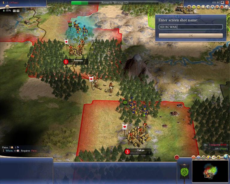
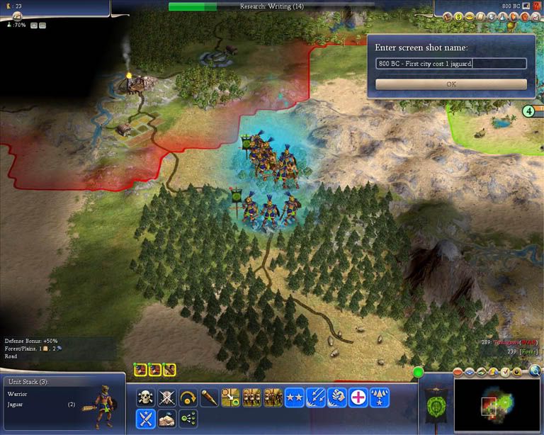
    Vel, why did you uprgrade your Jags to City Raider (+20% City Attack) instead of Cover (+25% vs. Archers)? Since you were only fighting Archers the whole time, that would have been an extra 5% to each of your attacks...
    IMHO city-buster is a better choice, though you might want to make a few two Cover to deal with Barbarian Archers and Japanese Archers in the open.

    City Raider II is +25%, and City Raider III is +30% and +10% vs. gunpowder. Thus when the attackers gain their 3rd promotion, which will happen quickly after combat, City Raider II gives the same bonus as Cover + City Raider I. If they reach the 4th promotion, which is tougher, the balance shifts the other way as City Raider III is +75% total vs. +70% for Cover and City Raider II.

    The important thing though is that City Raider III is valuable until Tanks and Bombers make infantry forces too slow, whereas Cover becomes obsolete when your opponents get gunpowder, and doesn't help against other defenders like Spearmen and Pikmen. Typically my ancient-through-Medieval attackers that have made City Raider III are invaluable when I promote them to Grenadiers or Riflemen, which can't take the City Raider promotions otherwise.

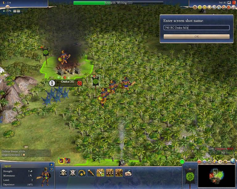
    What I don't understand is why Vel attacked the entrenched resource defenders. I usually bypass resource-defenders if I have enough to crush the city defenses. After you take the city and the resource is no longer in enemy territory, the resource defenders will immediately move and lose the +25% from fortification. I then pick them off as they head for friendly territory.

    - Gus

    Comment


    • #32
      After you take the city and the resource is no longer in enemy territory, the resource defenders will immediately move and lose the +25% from fortification. I then pick them off as they head for friendly territory.
      If your culture however, were too engulf that resource, he is now in position to pillage it. Wasnt vel's case but it does happen.
      --------------------------------------------------------------------------------------------------------------------------------------------------
      The phaonmneal pweor of the hmuan mnid, aoccdrnig to a rscheearch at Cmabrigde Uinervtisy, it deosn't mttaer in waht oredr the ltteers in a wrod are, the olny iprmoatnt tihng is taht the frist and lsat ltteer be in the rghit pclae. The rset can be a taotl mses and you can sitll raed it wouthit a porbelm. Tihs is bcuseae the huamn mnid deos not raed ervey lteter by istlef, but the wrod as a wlohe. Amzanig huh?...So with that said: if you can not read my post because of spelling, then who is really the stupid one?...

      Comment


      • #33
        Vel do you have any plans to come back to one or two of the workshops to play farther?

        Actually, I already have (finished the Roman game the other day)...I just haven't posted any of that stuff here...that was my "off duty" fun!

        My hope is though, that folks will either take the "before" or "after" positions and play them out, and then post questions in the appropriate Workshop thread if they run into trouble (and perhaps even a save game at that later point).

        My OTHER hope is that by going over individual and specific types of plays, it'll serve as preventive medicine (an ouce of prevention is worth a pound of cure...what we're REALLY doing here is teaching not only specific playbook plays, but how to THINK THROUGH the game, so you never wind up in trouble in the first place. If we can do that, and really get the fundamentals locked down, the mid game and beyond will take care of itself/build on its own success)....at least, that's the thought behind it all.

        Oh I hope you at least got enough for a tip from the Smax book I bought. Funny thing is I no longer had the game, just wanted to read it and lend a bit of support to the efforts.

        Thank you! That's the coolest thing about the 'net....the ability to meet people from all parts of the planet, and keep in touch with them.....in the olden days, when authors would affiliate themselves with a particular bookstore, they'd "hand sell" their books at the front door, and get to know the folks who read their works.

        The 'net offers the same KIND of "get to know the folks who are reading your stuff," losing the face-to-face part (which IS a loss ), but gaining so much in scope (a good chunk of the planet vs. the regulars at the corner store).

        That rocks!

        RE: City Raider vs. Cover

        Been thinking about this, and I don't think I'd have done it differently in this case. Here's why:

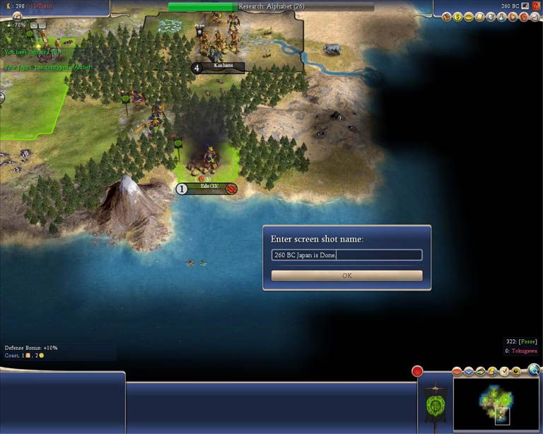
        * Jags are slow movers. Even if Japan HAD resources, he would have/could have had them hooked up and in use before I arrived (meaning there could have been a variety of defenders already built....chariots, spears, axes, etc). Didn't know, so best bet was to err on the side of caution.

        * Once I saw the preponderance of archers, and the high survivability of my guys, it was easy to make their NEXT promotion "cover" and thus, reap the benefits twice (once for city raider, and again for cover).

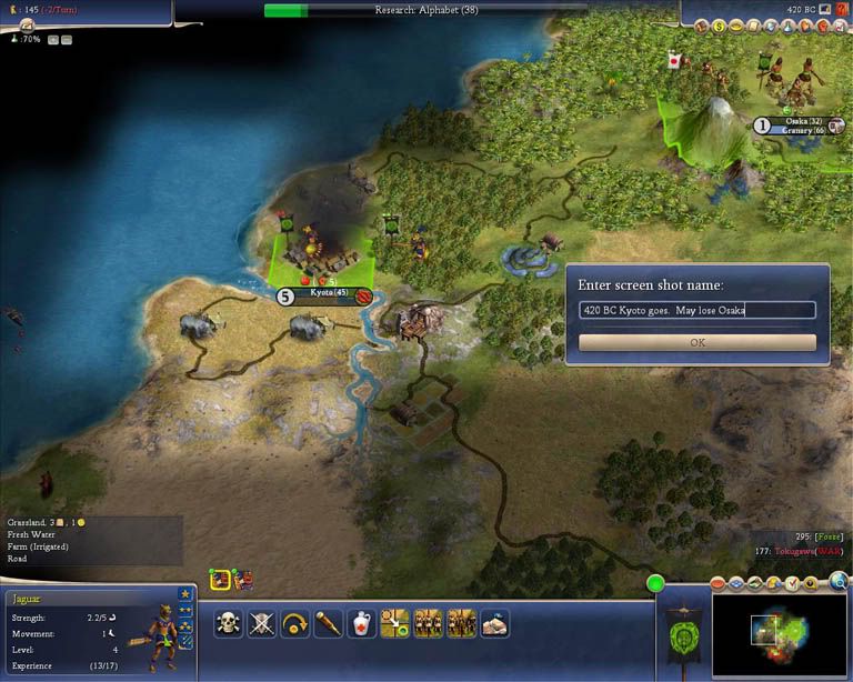
        * No good way for slow movers to "zip in" and nix a resource. Given the early nature of the attack, the borders were close, meaning that by the time I'm adjacent to the resource, I'm also adjacent to the city . Take it out, borders collapse, no more problem anyway. The only time this DIDN"T apply was in the last battle (at Kyoto), but by then, the war was well and truly over anyways.

        And finally....the reason I picked off those stragglers sitting on resources? Two of them:

        1) More experience/easy promotions (5 vs. 3, fortification bonus, but no city bonuses)

        and

        2) Because I knew I could....

        -=Vel=-
        The list of published books grows. If you're curious to see what sort of stories I weave out, head to Amazon.com and do an author search for "Christopher Hartpence." Help support Candle'Bre, a game created by gamers FOR gamers. All proceeds from my published works go directly to the project.

        Comment


        • #34
          Hey Vel great work on this and all your contributions.

          I'm curious about the comment you made early on about the puported link between the Incas and Indians....Is this some Graham Hancock idea? I'm familiar with most of the theories about ancient civilizations, pre ice age stuff but have not heard of this particular one.

          Thx in advance

          Comment


          • #35
            There's this:


            Which is fascinating reading all by itself, and then, if you want to get a little "farther afield" there's a book by Gene D. Matlock, over at the Booksurge site (http://www.booksurge.com) about Atlantis that I find.....perhaps a bit far fetched, but intriguing nonetheless.

            An excerpt OF the Matlock book is below (which you can also find at the Booksurge site)


            Why Not Look for A-Tlan-Tis in Mexico?


            “The Language of a Mighty People is the Greatest History.” (Edward Pococke; India in Greece.)

            “Everyone on Earth Had the Same Language and the Same Words.” (Genesis 10:1.)

            “1. Let it be granted that the names given to mountains, rivers and towns, have some meaning. 2. Let it be granted that the language of the name givers expressed that meaning. 3. Let it be granted that the language of the name givers will explain that meaning.” (Edward Pococke; India in Greece.)

            If Edward Pococke’s above three propositions are valid, then we can come to only two conclusions in this book: Atlantis existed - in Mexico! And India is the mother of both.

            Of all the frequently told myths and legends on earth, the one about ancient Atlantis has never ceased to be popular. More than 25,000 books, plus countless other articles have been written about this fabled confederation of city-states. Yet, speculation continues, especially as to where it was located. Every place on earth has become a candidate. One article I recently read on a certain website states that Atlantis existed on some planet in Outer Space. Another assures us that it existed only as a particular dimension of human awareness.

            In Timaeus (24), Plato pinpointed the location of Atlantis so clearly that I, at least, am amazed that anyone would think that it is any place other than the Americas:
            This power came out of the Atlantic Ocean, for in those days the Atlantic was navigable; and there was an island situated in front of the straits which are by you called the Pillars of Heracles; the island was larger than Libya and Asia put together, and was the way to other islands, and from these you might pass to the whole of the opposite continent which surrounded the true ocean; for this sea which is within the Straits of Heracles is only a harbour, having a narrow entrance, but that other is a real sea, and the surrounding land may be most truly called a boundless continent.
            Now in this island of Atlantis there was a great and wonderful empire which had rule over the whole island and several others, and over parts of the continent…
            …there occurred violent earthquakes and floods; and in a single day and night of misfortune…the island of Atlantis…disappeared in the depths of the sea. For which reason the sea in those parts is impassable and impenetrable…and this was caused by the subsidence of the island.

            Libya was the Greek name for the whole of Africa. Both Americas are greater in size than Africa and Asia combined. In olden times, ships could sail from and to these two continents safely because the whole area was lined with a number of large and small islands between Europe and America. A ship was probably never over a day’s distance from land. After the death of Atlantis, the ancients (that is, everybody except the Phoenicians) had to cross the Pacific Ocean, which also had numerous islands and safe harbors, to reach what are now Meso- and South America.

            The names that the Incas, Nahuas, and Mayas gave to sailing vessels indicate that after the Great Flood, the Phoenicians generally went to the Americas via the Pacific Ocean. A Sampan is a seaworthy flat-bottomed sailing barge that was once common in China, Japan, India, and the South Seas. The word is derived from the Sanskrit Sam (Association; Company) plus Pan (Trade). The South American Indian coastal tribes called it Mayu (Skt: “Wealthy”) Chimpana. For the Nahuatl speakers it was Chan-Pan (Moving House). The Mayans used the East Asian version: Sam-Pan (Moving House). The Sanskrit term for “floating wooden vessel” was Van-Plu, also Va-Plu (“Floating Transport”). The Hawaiians and other South Pacific islanders’ word for “rowboat” was Wa-Apa; the Incas called it Wam-Pu.

            The “boundless continent,” which Plato said Atlantis controlled, had to be both Americas. As Plato said, the Pacific Ocean separated Atlantis from other land masses lying westward. East Asia?

            Plato explained that the volcanic explosion which destroyed Atlantis had left a huge, muddy barrier, possibly a swamp, beyond the Pillars of Hercules (Gibraltar), keeping ships from going farther westward. Skeptics have used his statements to prove that he had invented the story of Atlantis. Gradually, over the centuries, this muddy swamp dissipated, worn away by the movements of the sea and tides. Even now, the 1,300 low-lying islands of the Maldives, a still visible relic of Atlantis’ twin brother Lanka, are being destroyed in this fashion. Geologists say that by 2050 AD the small nation of Maldives will have sunk under the sea forevermore, just as Atlantis did.

            The huge floating expanse of aquatic salt-water plants called the Sargasso Sea also could have persuaded many sailors not to venture farther westward. Until this day authors sometimes write dismal fictional stories about ships getting tangled in those seaweeds, never to escape.

            Although Atlantis could have extended far beyond the regions I discuss in this book, as much as possible I intend to stay well within the boundaries of the Gulf of Mexico and the Caribbean sea; Plato said that Atlantis lay just beyond a group of smaller islands which are our present day Antilles or West Indies. It’s more than possible that Atlantis extended beyond this region. However, if this riddle is to be solved once and for all time, we must start on solid foundations, venturing eastward step by step. The existence of Atlantis can definitely be proven if we slowly move eastward from Mexico’s eastern shores.

            Etchings on Phoenician coins often contain maps of the whole world. Yes, they even include the Americas! Mark McMenanim, a geologist at Mount Holyoke College in Massachusetts, believes that the Carthaginians cast gold coins produced between 350 and 320 BC, depicting maps of the Mediterranean world with India to the East and America to the West.

            When McMenanim enlarged pictures of some of those coins with his computer, he was amazed to note how the strange markings on them resembled maps made by Ptolemy, the Greek astronomer and geographer. The maps show what appears to emphasize the Mediterranean region, with Sardinia as a dot in the center. The north coast of Africa appears at the bottom. Europe is arched above the Phoenician homeland and India. The Strait of Gibraltar lies to the west; after that is the land mass of America. When skeptics see the enlargement of the coins, they become convinced of the correctness of this geologist’s opinions.

            For reasons we can now easily suspect, the Carthaginians, who were Phoenicians, made laws forbidding any non-Phoenician craft to venture beyond the Strait of Gibraltar. Only in the presence of a Carthaginian government representative could certain individuals venture beyond the Strait of Gibraltar. Anyone caught challenging Phoenicia’s hegemony over the Atlantic ocean was put to death. Phoenician ship captains and their crews were ordered to commit suicide and sink their ships on the open sea, rather than let others follow their secret trade routes. The Phoenicians also reinforced non-Phoenicians’ superstitions about the potential perils of sailing across the Atlantic. Today, no one can understand such possessiveness. The Phoenicians, however, did not see their nationhood in terms of land boundaries, but in terms of all the oceans, seas and coastlands of the world. With huge warships and armies of Celtic mercenaries, themselves descendents of Phoenicians, they defended their right to own those oceans.
            The Greek historian Diodorus Seculus said the Carthaginians possessed a large and rich land far out on the Atlantic ocean. According to him, the Phoenicians had found it by accident when some ships got lost off the coast of Africa and were carried to the island by the Atlantic currents. Diodorus said the Carthaginians would not tell anyone the location of this island. When the Spaniards invaded the Americas, the natives told them about a mysterious nation called Cabeiri, somewhere in what is now Northern Mexico and the American Southwest. The Spanish called it La Gran Quivira (The Great Quivira).

            Plutarch (2 AD) wrote that both the Phoenicians and the Greeks had visited this island which lay on the west end of the Atlantic. The Greeks even intermarried with Native-American girls.

            Before the eastern part of Mexico (Atlantis) became the bottom of what are now the Gulf of Mexico and Caribbean sea, the present narrow strip of swamps and the river Chimalapán connecting Southern Veracruz and Oaxaca, the Isthmus of Tehuantepec, was a wide waterway uniting the Gulf of Mexico with the Pacific. About four thousand years ago, sailing vessels could and did easily cross from the east coast of Mexico to the Pacific in about two days. Hundreds of years after Atlantis submerged, Phoenician traders passed through the Isthmus from both the Pacific and the Atlantic.
            From the days of the Spanish conquest, the people of Mexico have dreamed of widening the Chimalapán (Sheemala-pahn) river and others, reconnecting the two coasts. In North Indian languages, Shimal = “The North;” Pan = “Phoenician; Trade.” Thus, Shimal-Pan = “The North Phoenician.”

            During the 1950s, my lifelong friend Haig Kurdian and I once crossed part of this wide expanse of water-logged swamp and narrow rivers on a trip we took to Costa Rica. In those days, it was almost impossible to cross the Isthmus of Tehuantepec by auto alone. However, the railroad did go to the Guatemalan border. We had to load Haig’s auto onto a flatcar.

            Farther to the south of the Isthmus of Tehuantepec, we find Panama. Its name also derives from Sanskrit or Kashmiri: Pani (Phoenician; Trader); Maha (Greater; Great). Pani-Maha = “The Greater Phoenician.” Evidently, the ancient Phoenicians and Atlanteans preferred to reach either of the two oceans via the Panama route.

            In Nahuatl, Pan or Opan means “traveling or sailing from one side to another.” However, we must take into account that the Panis named those waterways; their homes were the great seas and rivers of the world. Nahuatl Apantlaca = “People who live on the water,” the same name that the Hindus of India also called them. The Hindu holy books say, “Pani lives on water.”
            The Usumacinta (“Oo-soo-mah-SINT-ah”) River snakes between the common borders of Mexico and Guatemala. It is Mesoamerica’s largest and longest river, with a basin of 106,000 square kilometers. The sixth largest river in Latin America, it represents 30% of Mexico’s fresh water. The Usumucinta was extremely sacred to the Mayans and was a center of their culture. Several Mayan archeological sites are located on its banks. Even the word Usumacinta derives from Sanskrit or Kashmiri. Usuma could have been derived from either the Sanskrit Zamu or the Kashmiri Shuma, meaning “Peaceful; Tranquil.” Although the Usumacinta is generally peaceful and meandering, its color is a brackish brown. Perhaps it received its Sanskrit name for its color: Shom (Dark-brown).

            Cinta (Cin-ta) is readily recognizable as the Sanskrit Sind, Sinde, or Sint, the ancient Persian word for “River.” Even in languages like German, Sint means “Sind; Indus.” Since this word Sint also means “Holy” in many languages, I am assuming that we derived Saint from Sind. For the Hindus, the Indus (Sind/Sint) river was and is equal with the Ganges in sacredness and as a center of Hindu culture.
            Several of the largest Amerindian tribes use variations of the word Hindu, Inde, or Sind in the Americas to identify themselves spiritually and culturally. I am going to separate each of these “Hindu” derivations by syllables so that you can more easily notice the relationship:

            The O’odhams of Southern Arizona call their way of life Him-day. In-de is the real name of the Apaches. In-ti and Hen-di-tre were Tarascan honorifics for the sun and their leaders. Among all the Nahuatl-speaking peoples, the honorifics Tzin and Tzin-tli were used. Un-dey(s) is the Inca word for the Andes Mountains they worshiped. In-ti Raymi (Hindu Rama) was the Inca Sun God. Many more tribes used similar derivations of Indus and Sind, but the European languages and traditions have successfully made them forget their Old World origins.

            These astonishing similarities cover a large part of both Americas - from the United States Southwest down to and including much of South America. It is highly unlikely that they are coincidences.

            If, as Plato stated, we can still cross the Atlantic ocean, inevitably reaching a place that all the Indians of Mexico once called A-tlan-tis, which is what much of Mexico still calls itself, do we need any other proof? History has proven that until now, everyone has disregarded the proofs that Plato, Diodorus, Plutarch, Herodotus, and the Phoenician maps have given us. Will I be an exception to the rule? I have my doubts.

            The pre-conquest Meso-Americans claimed that their primordial founding city was Tollán. The original name of the Toltec ruins of Tula, Hidago, on which the Mayan city of Chichén Itzá was modeled, is also Tollán. However, similar place names omitting the “O” exist all over Mexico: Atlán, Autlán, Mazatlán, Cihuatlán, Cacatlán, Tecaltitlán, Tihuatlán, Atitlán, Zapotlán, Minititlán, Ocotlán, Miahuatlán, Tecaltitlán, Tepatitlán, Tihuatlán, Texiutlán, and the like. Notice that the Nahuatl Tlán root of these place names is exactly like the Tlan in “Atlantis.” Tollán is just another variety of “Tlan” and the Sanskrit word Talan. The “n” part of both the Mexican and Sanskrit equivalents means “People.” Even in our English language, we do the same thing: America(n); Europe(an); Mexica(n); Russia(n). In both what were once North India (Southern Russia, Chinese Turkestan, Afghanistan, Pakistan, etc.) and Meso-America, the “n” suffix was often omitted, especially if the name of the place ended in Tal/Tala. In Mexico we find places like Tlaxcala; Mixquiahuala; Sinaloa; Guatemala; Cosalá; Ayutla; Mitla; Tonalá; Chapala; etc. Similar endings, from Southern Russia down to Pakistan, are Nepal; Coushala; Sinhala; Bhopal; Tal; Shawl; Kabul; etc.

            Besides the Tlán root, other Meso-America place names end in Tán and An: Yucatán; Juchitán; Champotón; Celestún; Comitán; Tehuantán; Rostán; Mexcaltitán; Tehuantán, etc. The regions from Southern Russia down to Pakistan, once part of India, also have place names ending in Tan and An: Afghanistan; Pakistan; Multan; Rajasthan; Tajikstan; Bhutan; Hindustan, plus many others. As in Mesoamerica, these Tan/An endings are stressed. Only in what were once ancient India and Mesoamerica are these Tan/An endings found so abundantly. There are many other similar linguistic correspondences between the two regions.

            The inhabitants of both regions even gave the same titles to their gods and leaders: The Mayan priestly class was called Chilam-Balam. Given the Mayans’ dislike of the “r,” in India such priests would have been known as Shi-Ram Brahm (Shiva-Ram Brahmins). The ancient Hindus called their hereditary leaders and warriors K****riya or Kashis. The Mayans called them Quiché (Kish-ay) and Cachikhel (Kashi-khel). In Sanskrit, Khel = “Family.” Ancient Indian princes and holy men were deified in their lifetimes, becoming known as Ishas or Isvaras (Messiahs). The Mayans revered them as Itzaes. The Mayan nation of primordial origin or “emergence” was Shivalva. In Sanskrit, Shivava = “Temple of Shiva.” The Northern Mexican state of Chihuahua lies contiguous to the United States. It was named after what the Native-Americans called the region. However, the Native-Americans pronounced the word as Shivava. The Amerindian name for the region which is Mexico’s state of Chiapas is the Sanskrit Shia-Pas (“Princes of Shiva”). Other India-derived place names in Mexico are as follows: Tamaulipas, derived from Tamralipta, an ancient port of Bengal; Colima (Kaul-Maha - “Great Brahmans”); Sonora (Sonita, name of a Hindu Devil. Sonora is one of the harshest deserts in the world); Tabasco (Tapas-Koh, “Place of Austerities” or “Shiva’s Place”); Campeche (Com-Peshe, “Trading Tribe”); Michoacán (Mishi-Khan, “Shiva’s Family); Jalisco (Halys-Koh, “Place of the Sun”); Zacatecas (Zaca-tokh; “Scythian-Land”); Tehuantepec (Devana-Tepec; “Divine Mountain”); Oaxaca (originally pronounced “Vashaka”) derived from Boshika (God Shiva); Nayarit (Nayariti); Sinaloa (Sinhala), plus hundreds of other similar correspondences. Historians say that the name of Veracruz was derived from the Spanish Ver la Cruz (Seeing the Cross), but more and more authorities are saying that “Veracruz” is a derivation of an Amerindian place name. If this is so, its true name is Vira-Kurus which in Sanskrit, means “The Hero Kurus,” a famous tribe that fled India after the Great Flood. Throughout the American Southwest down to the tip of South America, I can give almost a non-stop list of Hindu place and divine names.

            Had the English colonists of Belize not swept that country free of Native-American place names, few people today would have difficulty believing that the Americas and the ancient Hindus once had a tight relationship. Belize itself derives from a name of Shiva: Balusha. Its first capital, Belmopan, derives also from a name of Shiva: Balmuj-Pan (Shiva Phoenician). An Amerindian tribe called Rama lives in Belize.

            The country now called Mexico did not originally have that name. It is named after the Mexica (Meshika) a.k.a. Aztecs (really Aztatecas), a bloodthirsty, cannibalistic, and bellicose tribe that once lived in and around what is now Mexico City, about 50 to 75 miles in each direction. All the non-Meshika tribes, from Central America to our own American Southwest, hated and feared them. This negative legacy still exists among Mexico’s non-Meshika indigenous peoples who bitterly oppose being called mexicanos, even infecting the mestizo and white citizens inhabiting the various regions of this fascinating and enigmatic country. Such festering resentment fuels almost insurmountable political, social and economic problems in Mexico and will continue to do so.

            Movimiento Meshika is a small activist group seeking to force all Mexicans of Indian descent to speak Nahuatl, take on Nahuatl names, reject Spanish culture, and call themselves Meshika (Mexicans). But such a movement, if successful, would just divide and fragment Mexico even further. Even now, several Indian tribes in Mexico, such as the Totonacs, Mayas, and Huicholes, are plotting to shake off the yoke of Mexican hegemony. Troubles between the Mexican government and the Maya-related tribes in Chiapas have been keeping that region in turmoil for several years. Some Mexican intellectuals knowledgeable of their country’s linkage with Atlantis have told me that Mexico would be better served - possibly keeping it from cannibalizing itself - by restoring its original name: Atlán, Aztatlán, Tollán, or Tlan. They say that such a name change could unite all the different ethnicities and territorial factions as one truly national entity for the first time in Mexico’s turbulent history.

            Nahuatl scholar Angel Maria Garibay K. deplores the pro-Nahuatl activists’ zeal to restore Nahuatl as Mexico’s official language:

            What will be the future of the Nahuatl language? Although some who are blinded by the illusion of love, more than the discretion of understanding, have dreamed about its restoration, even as Mexico’s official language, such is not possible. No one by means of a single law can restore a (dead) culture, and because the Mayas, Zapotecs, and Tarascans would also demand the same right. The national language we all now speak is enough, and it can serve to unite the north and south, and from sea to sea. (Llave del Nahuatl; p. 330.)

            All the area south of the state of Sonora down to Chiapas contains an infinity of districts, villages, and cities with the root syllable Tlan contained in their respective names. This fact leads me to suspect that the Mayans were not an exclusive part of the Atlantean confederation. In fact, I have reason to believe that originally they were refugees from that other great ancient nation which sank under the waves: Lanka - the twin brother of Atlantis, an ancient, powerful Indian nation composed of thousands of islands which almost encircled the entire globe. Lanka was much greater and more highly civilized than Atlantis, but, thanks to Plato, it has received the least amount of publicity. Also, like the people loving to insist that Atlantis wasn’t where Plato said it was, there are those who prefer to call Lanka Lemuria and Mu.

            Like all the tribes of Meso-America, the natives of what is now Michoacán had close contact with India, especially with the Phoenicians. Their deities, place names, and some traditions prove conclusively that they immigrated to America from the Indus Valley. Authorities are also certain that immigrants from South America, possibly the Moshika, immigrated to Michoacán. The Phoenician gods of good fortune were the Cabeiri. The Michoacanos worshipped Cabeiri as well, whom they called Curi-Cauveri (Hereditary leader Cauveri), along with his consort. And, like the Phoenicians, the Michoacanos also sacrificed humans to their deities.
            …I was surprised to discover a great analogy between ancient Peru and Michoacán. The two peoples had the same institutions, the same religious practices, similar legends, and the two adored the sun. In Peru, in Venezuela, in other regions of South America and the Antilles we find many Tarascan names…(Michoacán, by Eduardo Ruíz; p. 25.)

            Because of the paucity of Atlán/Tlan place names in the United States, Northern Mexico, extreme Southern Mexico, Central and South America, I have concluded that many Indian nations of the present Americas did not belong to the Atlantean confederation, but to other associations of Indian immigrant nations. The northern half of Mexico, including our Southwestern United States, belonged to a confederation called “The Great Cabeiri” (La Gran Quivira), the Phoenicians who mined the earth of its valuable metals and precious stones. Places, sacred and tribal names in Mesoamerica and Southwestern United States emphasize this fact only too clearly. There were also two American “Atlantises;” not one. The second “Atlantis” was Lanka-Atalantes, composed of what are now The Yucatan Peninsula, Guatemala, and all the other nations of Central America. Even the Olmecs were called Xilanca (“Shee-LAN-kah”) - “People of Ceylon.”

            The observant reader, while admitting that the root syllable, Tlan, exists also in “Atlantis,“ may want to know why the initial A and final Tis are missing in Mexican place names containing Tlan.

            Hard evidence suggests that Sanskrit is the father of most world-class languages. If we use Sanskrit to explain the true meaning of “Atlantis,” we’ll learn that the initial “a” means “Not; no longer.” The final Tis derives from the Sanskrit Desa, Des, or Tes, meaning “Nation.” Atlantis = “No-Longer-the-‘Tlan’-or-‘Tollán’-Nation.” When A-Tlan-Tis sank under the ocean named after it, it certainly ceased to exist. However, the westernmost extreme of Atlantis, which is Mexico, is still above water. It continues to be Tollán or Tlan.

            Now that we have established the meaning of the initial A and final Tis in “Atlantis,” we must search for the meaning of Tlan or Tollán. In Sanskrit, Tala = “Surface; a place on the surface.” The “n” refers to the people living on this surface. A (not; no longer)-Talan (on the surface)-Tes/Des (nation; land. Tlan or Tollán (Mexico) is the part that remained above water. Even in Nahuatl, Tlan/Tollán = “Surface; a place.” In Greek, Tala means “To bear; support; hold up.” Tala is also one of the thousand and eight epithets of God Shiva. Talan, therefore, means “People of Shiva.”

            Atala = “Not to bear; not to hold up; bottomless.” Like the word Patala, Atala also means “Hell; Bottomless Pit.” The Hindus used both names to refer to the Americas. Thus, Patalan and Atalan mean “People of Hell.” Lanka-Atala was “The Lanka Underworld or Hell.” Before you finish this book, you’ll know exactly why the ancient Indians believed that America was “hell.”
            The list of published books grows. If you're curious to see what sort of stories I weave out, head to Amazon.com and do an author search for "Christopher Hartpence." Help support Candle'Bre, a game created by gamers FOR gamers. All proceeds from my published works go directly to the project.

            Comment


            • #36
              More from the Matlock excerpt (it's long, but once you get into the reading, really quite fascinating...if you stick with it, I promise you'll be glad you did!)

              One of the greatest archeological zones ever discovered in Mexico, during the 1990s, was (el) Pital, which could easily be a derivation of Patal/Patala, as America was once called. Of course, some authorities may point out that this word derives from the Native-American word Pita, a member of the agave plant family. But even the authorities will admit that this word is extremely vague; no one knows what it really means. Also, investigators should ask themselves why many of the most important names for America, and parts of it, occur in the Veracruz and Yucatan areas, exactly where they should be found, if what I’m saying in this book is true.

              The following article, “An Ancient 'Lost City' is Uncovered in Mexico,” by John Noble Wilford, was published in the New York Times, Friday Feb. 4, ’94:

              In a lush river delta on Mexico's Gulf Coast, archeologists have found temple mounds, ball courts and other traces of a sprawling pre-Columbian seaport city that flourished more than 1,500 years ago and may have been a vital center of ancient culture and coastal commerce. A preliminary survey of the site, about 60 miles northwest of the modern city of Veracruz, has revealed the ruins of more than 100 earth-and-stone pyramids and other structures, some reaching heights of 130 feet, that had long remained largely hidden under dense vegetation. The core city and its suburbs extended over 40 square miles and were occupied by thousands of people, possibly more than 20,000, large for that time and region. No one is prepared to say who these people were. The city, which existed between AD 100 and 600, rose after the disappearance of the Olmec civilization, once strong along the Gulf Coast, and centuries before the Aztecs of central Mexico. It was contemporary with the Classic period of the Maya, but they lived several hundred miles to the southeast. It probably had strong cultural and trade ties with Teotihuacan, the powerful urban center near present-day Mexico City. In any event, the ancient city, called El Pital for a nearby village, is thought by its discoverer to be one of the most important archeological discoveries in the Veracruz region in more than 200 years…The discovery was announced yesterday in Mexico City and Washington and was described in the current issue of National Geographic Research and Exploration, a quarterly journal of the National Geographic Society. The society and the Selz Foundation of New York City helped finance the research by S. Jeffrey K. Wilkerson, an independent archeologist who made the discovery. In the journal article, Mr. Wilkerson said that El Pital “may well alter our concept of Mesoamerican culture history,” calling the city “pivotal in both time and space to the emergence of classic civilization,” the period of urban growth and cultural splendor that ran from AD 250 to 900 for many cultures in Mexico and Central America. Mr. Wilkerson is an American who has lived in Veracruz for more than 20 years and conducts archeological research through his own Institute for Cultural Ecology of the Tropics. He is also associated with the Smithsonian Institution's National Museum of Natural History. His explorations at El Pital were authorized by the National Institute of Anthropology and History in Mexico City… “It's a very interesting site,” said George Stuart, director of archeological projects at the geographic society. “It's important and needs to be investigated.” Like other archeologists, however, Mr. Stuart cautioned that no systematic excavations have been conducted and until they are, nothing definitive can be said about the city's role in pre-Columbian culture. But the prospect of finding elaborate ruins, possibly of a culture unknown until now, is exciting for archeologists specializing in pre-Columbian exploration. The coastal regions north of Veracruz have been largely neglected because reconnaissance and excavations are difficult in the area's dense jungle and because research has long seemed to be more rewarding in the central highlands around Mexico City and in the Maya country to the south. The El Pital site lies nine miles inland from the Gulf of Mexico, upstream on the Nautla River at the head of navigation. Mr. Wilkerson noted that in El Pital, unlike most Veracruz urban centers of that period, which were in defensible valleys and ridges, security “is likely to have rested on its direct governance of a broad region, far greater centralization than its immediate neighbors and alliances of lineage or commerce that place it at the hub of a regionally valuable network.” One of the best known ancient cities in Veracruz was Matacapan, which sprang up in the south around AD 400. Archeologists have surmised that this city thrived by long-distance trade and was dominated by possibly colonial ties to Teotihuacan… Mr. Wilkerson said he found many Teotihuacan style ceramics. But local styles, particularly in figurines and vessels, were also strong, he said, indicating that El Pital “is likely to have had a far more complicated role than that of a trade way station or Teotihuacan outpost.” Mr. Wilkerson noted that some murals in Teotihuacan depict a riverside scene of raised agricultural fields, a farming practice at El Pital, and dense tropical flora. Since nothing like that could be found in the semi-arid plain of Teotihuacan, he said, this could be an image of El Pital “as a sort of Eden,” reflecting its apparent role as a major center for food production. El Pital is significant, Mr. Wilkerson said, “because it appears to be the principal end point of an ancient cultural corridor that linked the north-central Gulf Coast with the cities of central Mexico.” One research goal will be to determine the city's importance as a seaport and the extent of its coastal reach in trade. Some scholars have even suggested that corn and some cultural practices traveled from central Mexico to the Mississippi River valley about this time, either by overland or sea trade. Dr. Norman Hammond, a Boston University archeologist who specializes in Mesoamerican studies, said it was impossible to conclude from present knowledge whether Mexico was the direct source of these innovations among the Indians of the Mississippi Valley. The newly discovered site resembles in at least one respect another ancient city in the region, El Tajin, found some 40 miles away in 1785. A prominent feature in both were courts used in a ritual ball game that often involved sacrificial decapitation of some players.

              Fragments of stone depicting aspects of the games, including figurines representing perhaps sacrificed ballplayers, were found at the site. For centuries the El Pital site was obscured by rain forest. The land was opened to agriculture in the l930's and is now heavily planted in bananas and oranges. People who lived there and worked the fruit plantations took the mounds for granted, assuming they were natural hills. “This reminds us,” Mr. Wilkerson said, “that the time has come in the largely deforested tropics to carefully search for the 'lost cities' we have overlooked.”

              In a 11-16-2000 Los Angeles Times article, feature writer Christine McDonald described the past beauty and productivity of El Pital in its heyday:

              At the center of Wilkerson’s work is the question of how the ancient people of Veracruz turned rain forest into thriving urban centers and maintained a millenniums-long balance with the delicate tropical environment. Part of the answer he says, has to do with how they dealt with chronic flooding during a wet season that lasts for most of the year along Mexico’s central Gulf Coast.
              Since the 1970s, Wilkerson has examined the ancient farming technology used to transform the deltas, estuaries and surrounding hillsides of the Tecolutla and Nautla rivers into terraced agricultural plots. People still use a form of this ancient farming technology to grow orchids in the Xochimilco neighborhood of Mexico City.
              The plots produced food for cities with tens of thousands of residents and helped contain flood waters, “providing water for dry season agriculture and removing excess water during the rainy season,” Wilkerson wrote in a 1983 British research journal.
              The gardens also graced El Pital, where Wilkerson has worked for seven years with National Geographic, Smithsonian Institute and Mexican government backing.
              El Pital’s architects transformed watery geography into a city of towering buildings more than 100 feet high, ceremonial ball courts and elegant gardens traversed by waterways. Intensive farming techniques on the city’s outskirts were so successful that they provided for local residents and export to other ancient cities.
              The engineering genius is clearer when compared to the region today. After its decline 14 centuries ago, El Pital was reclaimed by the rain forest until farmers and ranchers began clearing the forest to make way for cattle, banana, citrus and other crops in the 1940s.
              In just a few decades, modern farming has ravaged the delicate environment that ancient people cultivated for centuries. The clear cutting appears to have exacerbated chronic flooding…

              Wilkerson says that there is evidence that even the ancient cities succumbed to massive floods every 400 or 500 years…(A Flood of Evidence; p. B2.)

              Patala was described in ancient Hindu mythology as a place of abundant water soaked in the ground, under it, above it, and falling from the sky. The Mexican Atlantis more than fits such a description.


              A Hindu myth states that the God Vishnu (just another name of Shiva) once went to Patala-Loka (The Underworld or America) to help the people recover from a huge flood which had destroyed their society. The myth states that a worldwide fire once reduced the surface of the earth to ashes. I have interpreted this part of the myth to mean that Man himself destroyed his environment through slash-and-burn farming, along with other unscientific agricultural practices.


              The God Vayu then blew huge rain clouds all over the earth, causing torrential rains to fall. After the rains had washed away the once-fertile topsoils in the Vera Cruz area, God Vishnu went there and fought a war with the demons who had caused this severe deluge. Then he drained away the excess water, causing the earth to rise above the water again. In other words, he just educated the natives in correct agricultural practices.
              Vishnu expressed his desire to reside on the Earth to protect its people. He commanded his vehicle, Garuda (a Divine Eagle) to fetch Kridachala (an extensive mountain chain with lofty peaks, embedded with gold and precious stones) to America. Although this part of the myth may be incomprehensible to many people, it just means that God Vishnu ordered the ancient Meso-Americans to diversify their economy. If mining was to be included in this new, diversified economy, as the myth appears to suggest, we can reasonably infer that God Vishnu was none other than the Phoenician Cabeiri who had decided to extend their operations in America to include mining and manufacturing.


              God Vishnu’s representative on earth had to be none other than the Mexican deity Quetzalcoatl. I say this because Vishnu’s Vimana (modes of transportation) were an eagle and a raft of snakes. Quetzalcoatl’s Vimana were also an eagle and a raft of snakes. The eagle signified the ability of those ancient travellers to traverse long distances, heedless of obstacles. The raft of snakes was just the Phoenician Nagas on their ships, the prows of which resembled snakes and dragons.
              The following description of the world’s first truly civilized race from India, the Nagas, was taken from the Encyclopedia Brittanica:

              Sanskrit NAGA ("serpent"), in Hindu and Buddhist mythology, a member of a class of semidivine beings, half-human and half-serpentine. They are considered to be a strong, handsome race who can assume either human or wholly serpentine form. They are regarded as being potentially dangerous but in some ways are superior to humans. They live in an underground kingdom called Naga-loka, or Patala-loka, which is filled with resplendent palaces, beautifully ornamented with precious gems. Brahma is said to have relegated the nagas to the nether regions when they became too populous on earth and to have commanded them to bite only the truly evil or those destined to die prematurely. They are also associated with waters--rivers, lakes, seas, and wells--and are generally regarded as guardians of treasure. Three notable nagas are Shesa (or Ananta), who in the Hindu myth of creation is said to support Vishnu-Narayana as he lies on the cosmic ocean and on whom the created world rests; Vasuki, who was used as a churning rope to churn the cosmic ocean of milk; and Taksaka, the tribal chief of the snakes. In modern Hinduism the birth of the serpents is celebrated on Naga-pañcami in the month of Sravana (July-August).


              The female nagas (or nagis), according to tradition, are serpent princesses of striking beauty, and the dynasties of Manipur in northeastern India, the Pallavas in southern India, and the ruling family of Funan (ancient Indochina) traced their origin to the union of a human being and a nagi.


              In Buddhism, nagas are often represented as door guardians or, as in Tibet, as minor deities. The snake king Mucalinda, who sheltered the Buddha from rain for seven days while he was deep in meditation, is beautifully depicted in the 9th-13th century Mon-Khmer Buddhas of Siam and Cambodia. In Jainism, the Jaina Saviour (Tirthankara Parshvanatha) is always shown with a canopy of snake hoods above his head.
              In art, nagas are represented in a fully zoomorphic form, as hooded cobras but with from one to seven or more heads; as human beings with a many-hooded snake canopy over their heads; or as half human, with the lower part of their body below the navel coiled like a snake and a canopy of hoods over their heads. Often they are shown in postures of adoration as one of the major gods or heroes is shown accomplishing some miraculous feat before their eyes.

              The above description of the Nagas stated that because they had become too populous in India, they were sent to other parts of the world, especially to Patala. These Nagas were the ones who built the beautiful floating gardens in Kashmir. The Kashmiris produced the world’s first great civilization, even antedating the Sumerians. They brought their expertise to America.

              Originally, the Asuras or Nagas were not only a civilized people, but a maritime power, and in the Mahabharata, where the ocean is described as their habitation, an ancient legend is preserved of how Kadru, the mother of serpents, compelled Garuda (the Eagle or Hawk) to serve her sons by transporting them across the sea to a beautiful country in a distant land, which was inhabited by Nagas, The Asuras (Nagas) were expert navigators who possessed very considerable naval resources and had founded colonies upon distant coasts." (The Encircled Serpent, by M. Oldfield, p. 47.)

              Proof that Quetzalcoatl was from India

              1. Tal/Tala = “Top; Surface.” Atal/Atala = “Under the Surface.” Therefore, if America is “The Underworld,” India must be “The Upperworld.”
              2. Talan is the Sanskrit word for “People of the Surface.” Atalan, logically, must be “People of the Underworld.” I must conclude that the Nahuatl-speaking peoples’ primordial fatherland was Talan, which they called Tollan/Tlan; i.e., Northern India.
              3. As I have already stated, the Vimanas or modes of transport of both Quetzalcoatl and the Indian Vishnu were an eagle and a raft of snakes.
              4. Quetzalcoatl was said to have returned to a place called Tlapallan. Tal/Tala = “The Upperworld” or India. Pallan may refer to “People of Pala” or what is now the Indian state of Bihar. This is the province from where, after the Great Flood, the Pelasgo or Palacthon, considered the greatest builders and movers of giant stones in human history, left India for other parts of the world. Pallan may also be a derivation of Bolan, which lies in Beluchistan, a province of what is now Afghanistan. Talan, or “People of Tal,” once lay a short distance to the northwest of Bolan. They were inhabitants of Talan-Des/Talan-Tes (“Land of the Talan’). Naturally, the opposite land, which was in Mexico, would have been known in India as Atalandes/Atalantes.
              5. A region in which Quetzalcoatl once traveled was Xicalanco, (pronounced “Shee-kah-LAHN-ko”). Although the Nahuatl meaning is “Place of Water Jars,” this word could have derived from the Sanskrit Shikar (Tiger Hunter) plus Lanka (Ancient Ceylon). The Nahua-speaking people could not pronounce “r.” They would have been forced to pronounce Shikar-Lanka as “Shika-lanka.” Ceylon was once famous for the fabrication of excellent pottery. Quetzalcoatl was often depicted as a jaguar; not only as a plumed serpent. The ancient Lankans were supposed to be descendants of male were-lions from India and Lankan women. The first foreign colonizers of Mexico were were-Jaguars and native Mexican women. This indicates strongly that these colonizers were from India.
              6. Nahu-sha/Nahu-shka, a Naga and one of several Hindu equivalents of our Noah, went on a civilizing mission to various nations of the world after the Great Flood. Since this word is so nearly identical to the name of the Nahuatl-speaking tribes of Ibero-America, I am tempted to infer that they regarded Nahusha as their “Primordial Father.”
              7. Even the word Quetzalcoatl (Plumed Serpent) announces its Indian origins from the housetops. The Quetzal is a beautifully feathered Meso-American bird. The feathers are so beautiful and resplendent that ancient Meso-American leaders used them as scepters or symbols of their authority. In Nahuatl, Quetzalli means “rich feather; beautiful; fine.” A symbol of kingly authority, the word is probably derived from the Sanskrit Ksiliza (King; Great Lord). Ka****l/Caxitl was the Nahuatl word for “scepter; kingly authority.” Hu/Khu was a North Indian or Phoenician word for “serpent.” Of course, Atal = “Under the surface.” Or, the ancient North Indian equivalent of Coatl, the Nahuatl word for snake, could have been Khu-Tala (Serpent Shiva). Even today, the snake is a symbol of Shiva.
              The North Indian word for serpent, Khu, spread throughout both Americas. In Arizona, the O’odham name for “rattlesnake” is Koh or Ko’owi. The Zuñi term is Ko-lowi’zi. The most common term for “rattlesnake” throughout Northern Mexico and Arizona is Co-rua. The Mayans call it Kuh; Gu among the Incas. Two other O’odham words for “snake” hail from North India; also: Nah-Big, which in Northern India is Nag-Beg. Another North Indian word for “snake,” Veh-Mar, barely changed in the O’odham language: Vah-Mat. English and Spanish have almost choked O’odham out of existence, but there are still enough Sanskrit derived words in the language, leading me to believe that had the Europeans never conquered the Americas, immigrants from India would have had no trouble communicating with them.
              Grierson’s Dictionary of the Kashmiri Language defines Kta as “the name of deadly black-coloured poison said to have been drunk by the Hindu god Siva at the famous churning of the ocean.” Another word derived from Kta, Kotil, means “deadly.” Kotil could have evolved to Coatl (Snake) after the Naga or Phoenician Indian mariners and colonizers left the Americas.
              8. An ancient Sanskrit word for “Buddha” is Put. A “Put” or “Buddha” is a god, demi-god, or saint who is reborn in human form, in order to continue the moral purification of mankind. In the state of reincarnation, a Put in human form becomes a Putara (Messiah). The Nahua-speaking peoples also called Quetzalcoatl by the exact name: Ishi-Putala/Ptla. (The Nahuas could not pronounce “r”.) The above Nahuatl expression translates as “Skin of a God.” Nearly all the Amerindian peoples worshiped Ish (Shiva) by his various names, almost exactly as in India. Even Shiva is another name of the Buddha.
              These Sanskrit, Kashmiri and Nahuatl words are too nearly exact, both in meaning and in pronunciation, to be “coincidences.” I dare anyone to find such similarities in languages other than Sanskrit, Persian, Kashmiri, and Nahuatl.
              I can keep listing many other proofs, but I don’t want to load the book unnecessarily with too many boring details. For example, the name of the Aztec God of Rain, Tlaloc, is especially revealing. Tal/Tala = “Upper; Surface” in Sanskrit. In the same language, Loki = “Region; World; Land; From that region.” It is also the Sanskrit word for Lanka. In Nahuatl, Tlaloc means “He who is on the earth,” a name which is more than similar to “From the top of the Land.” Tlaloc’s mythical homeland was Tlalocan. Since rain always falls from top (Tala) to bottom (Atala), it’s only natural to assume that people of that relatively unenlightened and unscientific period of human history would regard Tlalocan as Tlaloc’s place of residence. The Indian or Lankan origins of many Aztec and Mayan deities can be found easily if investigators will divide such names into tiny syllables.
              The present floating gardens of Xochimilco give us a faint hint of the true beauty and splendor of the great civilization which the Nagas, Phoenicians, or Cabeiri, the same people with different titles and depicted in Mexican myths as Quetzalcoatl, brought to Patala or America. This civilization sprouted up on Mexico’s central and western coast, extending eastward to what are now the islands of the Caribbean or the Antilles, and northwards up to what are now the Florida keys - perhaps even to Florida itself.

              Imagine these unending stretches of flower and vegetable gardens, palaces, temples, canals and islands connected by drawbridges and levees, over such a great area. It was truly a paradise much more beautiful than that which Plato described. Except for my yet unproven statements that Atlantis extended to the West Indies, we do have scientific proof that this paradise existed just as I have stated. However, the man-made landscaping, the large buildings and temples, the canals, bridges, statues, and whatever else that existed in this area could not hide the fact that Atlantis was really no more than a thin, unsteady, rich carpet covering a large swamp. Moreover, it was in an area where rain fell much of the year - and still does. Monstrous hurricanes did - and still do - blow in from the Atlantic, often forcing the inhabitants to reclaim the land and build all over again. The Atlanteans had also adopted some of the more barbarous customs of their Phoenician fathers, such as human sacrifice and self-mutilation. Although the Atlanteans had more than enough to eat, good habitations, and abundant festivities, the constant threats of ravaging rains and hurricanes, along with the uneasy awareness that at any moment any of them could be chosen to have their hearts cut out on a sacrificial block - or have their heads cut off for just losing a ball game – certainly did not help them sleep more securely at night. There was no denying that the other side of the Atlantean coin was Patala or Hell!
              The list of published books grows. If you're curious to see what sort of stories I weave out, head to Amazon.com and do an author search for "Christopher Hartpence." Help support Candle'Bre, a game created by gamers FOR gamers. All proceeds from my published works go directly to the project.

              Comment


              • #37
                And, the last of the Matlock excerpt (I promise!)


                A Mexican political activist, Gary S. Trujillo, discussed the importance to Mexico of Mr. Wilkerson’s discovery on his website:

                The recent discovery of a pre-Hispanic port city on the shores of the Gulf of Mexico, which was anterior to the Aztec civilization and also contemporary with the first Mayan cultures, is the greatest archeological find registered until now after the localization of the ruins of El Tajin in 1785. Archeological experts and Mexican university investigators are now estimating that El Pital, where a total of 150 pyramids have been discovered, are, in all probability, going to change the existing concepts about the history and cultures of Meso-America.
                The archeologists with the National Autonomous University of Mexico (UNAM) received with profound euphoria this announcement which…the American professor, Jeffrey Wilkerson, made about the find in El Pital. But this cheerful emotional state lasted for just a short time when, on the following day, as the world media was lauding this find, neither the Mexican government, through the Council of Culture and Arts, nor the Mexican press itself gave any sign of knowing that something had just happened which could modify the pre-Hispanic history of this country.
                The pain caused by this lack of national interest did not keep Wilkerson and his National Geographical Society archeologists from revealing new information about this impressive find. El Pital would not only be regarded as the missing link among the cultures of the anteplain and the Gulf Coast of Mexico, but also as the most important discovery in the pre-Hispanic world, taking into consideration that the remains of this city extended over a radius of 60 miles. In spite of the fact that El Tajin lies at only 39 miles from the place where this port city has been found, El
                Pital is an extremely important find in this maritime region because it provides abundant information about the parallel development of urban planning with the natural environment. Also, this city is regarded as the predecessor of the classical cultures in this area of the Gulf of Mexico.

                Professor Wilkerson’s discovery prepares all humans everywhere to accept the truth that ancient Amerindian civilizations were already in place at the time of the Egyptian, Sumerian, and Indus Valley civilizations. This being the case, we find ourselves in the position of being forced to admit the possibility that at one time, both the Eastern and Western hemispheres enjoyed some kind of relationship.
                The reader should know that Sanskrit words always, and without exception, describe the state or function of place names. They are not names per se, but ideographs. Each word is composed of extremely short syllables, compounded in such a way as to convey accurate and vivid mental pictures. Before sinking under the Gulf of Mexico and the Caribbean sea, Atlantis was probably known as Ashtalantes. Ashtala = “ground; plain; mound; raised, dry ground; land (as the opposite of water.)” The many thousands of low-lying islands forming the nation of ancient Lanka were called Atholhu, derived from the Sanskrit Asthala. Our English word for “low-lying coral island,” Atoll, was derived from the Maldivian (Divehi) Atholhu. This “history book” word tells us that the geography of most of Atlantis, as well as that of Lanka, was generally neither mountainous nor on plains, as Plato believed; it consisted mainly of a long series of atolls extending outward from both sides of Sri Lanka or Ceylon, becoming a belt that stretched around nearly the whole globe. Even during the heyday of Atlantis and Lanka, these two nations were probably being slowly dissolved into the ocean, just as the Maldives are now.
                The above “history book” word aids us in learning how the Americas were probably settled. The ancient forefathers of the Amerindians and Atlanteans followed those islands to the Western Hemisphere as well as crossing over to Alaska from the northern Bering Strait. A number of authorities conjecture that there had to be some kind of connection between the Maldives and Easter Island, which lies about 2,000 miles off the Chilean coast. In those days, these atolls could have extended up to the South American mainland.

                Perhaps some of my readers are beginning to think that I believe most Amerindian tribal and place names originated in India. I admit that such names are more numerous and visible in Latin America. However, some tribes and places have non-Hindu names. The true name of the Zapotecs of Oaxaca, Beni-Gulaza, not only announces their Hebrew origins, but even their reason for being in Mexico: Beni = “Sons of;” Gulaza derives from the Hebrew Gulata, which means “Exile; Diaspora.”
                Columbus knew what the name of the Antilles (islands of the West Indies) would be before he arrived there.

                Antillia, which is the same name, if not the same island that the Cartaginians so zealously tried to keep secret, was regarded by the Hispanic peoples as the ideal place of refuge during the conquest of Spain by the Arabs. It is believed that the escaping refugees sailed toward the West, led by a bishop, and that they arrived safe and sound in Antillia, where they built seven cities. On ancient maps (Antillia) is generally located in the center of the Atlantic Ocean.
                The efforts of the Phoenicians and Cartaginians to close the Atlantic to other maritime peoples had the result of perpetuating the idea that the Atlantic was a sea of lost souls. Nevertheless, humanity never forgot the Fortunate Islands and other lost territories. Prior to Columbus, they appear over and over on maps, whether near Spain or in the Western Hemisphere.
                Toscanelli’s map, which was, according to what is believed, the one Columbus carried with him on his trip to the New World, shows Antillia. Years before the discoverer embarked on his voyage, Toscanelli wrote to him, recommending Antillia where he could anchor on his trip to the Indies. On his map, China and the Indies appear on the western coast of the Atlantic, while Antillia and other islands are located at intermediate points.
                It seems reasonable to assume that Columbus studied, or took with him on his voyage, the map of Becario, of 1435 and the later ones of Branco (1436), Pereto (1455, Rosselli (1463) and Bennicasa (1482). Also, it is probable that he took material or suggestions taken from the map of Benheim (1492). In all these (maps), Antillia appeared, with its diverse denominations, and generally located far out into the Atlantic, in a parallel line from Portugal. In this aspect, the Portuguese name Antilha (ante ilha), seems logical, which signifies “the island opposite,” “before” or “in front of,” because it refers to the great island in the middle of the ocean, the one having “seven cities.” This could be the real reason for its name, or just another form of writing Atlantis. (La Atlántida Está en México, by Eduardo Robles y Gutiérrez; pp. 63-64).

                Robles y Gutiérrez also discussed in detail the so-called Piri Reis map of the world, reputed to be at least 4,000 years old. Robles y Gutiérrez said that it would have been impossible for Columbus not to have had some acquaintance with this ancient map which many authorities believe was saved when the Moslems burned the world-famous library at Alexandria, Egypt to the ground.
                For those who believe that the word Atlán isn’t sufficient proof that Mexico once belonged to the land of Atlantis, more evidence is available. The Nahuatl word for “water” is Atl. Perhaps it evolved from the Atlán meaning “Not-Surface.” Therefore, Atlán came to mean “Nation of Water,” also “from, in, into, on, or through the water.” Atlanteca = “Citizen of Atlán or Atlantean.” The ancient Indians and the Nahuatl-speaking tribes in the Americas shared the same word for “Hill; Mountain”: Skt. Tepe; Nahuatl, Tepetl/Tepec. The early Mexicans also used it as an epithet of “Region.” Although I have no proof of this, the real name of Atlantis could have been Atlántepec.
                American Chicano political activists and poorly-informed historians like to mention a place called Aztlán as the primordial founding city of the Toltecs and Aztatecas. But there never was an Aztlán in Nahuatl mythology. It was called Aztatlán. On Mexico’s West coast, there is an Aztatlán, Nayarit. The Sanskrit word Asta means “Place of the Setting Sun” or “Westernmost Extreme or Boundary.” Could Aztatlán be the westernmost boundary of what was once Atlantis or “The Westernmost Land of God Shiva?” Additionally, the “Aztecs” were never Aztecas, but Aztatecas. Again, Asta means “Westernmost Extreme or Boundary.” Teca may be a mexicanization of the North Indian Attac from which was probably derived the Greek AUTOCHthon, meaning “springing from the same earth.” Aztateca = “Westerner.”
                In his book, Hindu America, India-Indian author Chaman Lal states:
                “At present we are studying the native tongues and find that at least as far as Nahuatl, Zapoteca, and Maya languages are concerned, they are of Indo-European (Sanskrit) origin.” The aforementioned studies are by Dr. Magana Peón and Professor Humberto J. Cornyn, both members of the Geographical Society of Mexico. (p. 14.)
                The eastern entry to Mexico would also refute the theory that the primordial Tollán (Shiva Land?) was Tula, Hidago, Aztatlán, Nayarit - or California as the Chicano political activists loudly declare. Tula (Shiva?) is slightly northwest of Mexico City and many hundreds of miles north-northwest of Mayan Yucatan. Aztatlán lies a few hundred miles northwest of Mexico City, on the Pacific Coast. Some 16th century Spanish priest-scholars speculated that the Aztatecas first entered Mexico from what is now either Florida or the Texas Gulf Coast. It seems probable that the ancestors of both the Aztatecas and the Mayans crossed at least part of the Atlantic Ocean (The Gulf of Mexico and the Caribbean?) to get to America.
                In the 1970s, Mexican investigator, Eduardo Robles y Gutierrez, published his book, La Atlántida Está en México (Editorial Diana; Mexico City). While he was working in Vera Cruz, he discovered the foundations of an ancient city in and near the region known as San Lorenzo Tenochtitlán. Three small villages, each sitting on and amidst important archeological ruins, are located there: Tenochtitlán, San Lorenzo, and Potrero Nuevo. To reach this area, one must start at the dirty, greasy oil town of Minatitlán, situated on the Coatzacoalcos River about 30 miles west of its mouth on the gulf coast. The Coatzacoalcos and its tributaries drain all of the northern half of the Isthmus of Tehuantepec. At one point in its course, the river splits and flows around a huge swampy island called Tacamichapa. According to the local people, this island belonged to Doña Marina or La Malinche, the famous Indian mistress of Hernán Cortés. The west branch of the Coatzacoalcos, which skirts Tacamichapa, is called the Chiquito River. After two hours’ travel from Minatitlán, the boat reaches the Chiquito. After another three to four hours’ travel through swamps and green jungle, the boat reaches the village of Tenochtitlán, so named because of the ruins there.
                Through research, Robles y Gutiérrez found out that the early Spanish residents of the port of Coatzacoalcos tore down the ruins of the buildings that had rested on the foundations of San Lorenzo. They sent the fabulous artifacts they found buried in the ruins, such as jade objects, precious metals and other treasures, even its finely polished stone building blocks, to Spain. In a later chapter, you’ll learn that those treasures could have been transported to Quivira, centuries before the Spaniards reached America.
                An ancient harbor of concentric circular channels, with high banks or dikes lining the channels, had once existed there, exactly as described by Plato. Robles y Gutiérrez said that the extremely fertile plains and jungles in the area are criss-crossed with the ruins of many ancient irrigation canals and lagoons, some with masonry still lining their banks and with drainage ducts still intact. He said that if the Mexican government just cleaned out and repaired those canals and ducts, water could start flowing through most of them again, enabling the country to cultivate millions of acres profitably and cheaply.
                The following are some quotes from his book:

                San Lorenzo is a large artificial plateau built with thousands of tons of dirt and debris…it looks like a low, flat-top mountain and is about forty meters high. Its longest extension, from north to south, measures approximately one kilometer. It is truly amazing that this great earthwork was made by human beings.
                This hill was built with large quantities of earth brought in from various places, to be used as a platform and also as a raised platform for hundreds of small buildings. Some of these plateaus were probably plateaus intended for religious functions; others, less pretentious… were probably used as habitations for the common people. Many of the foundations are still well preserved, as is the meseta in general, which is made exclusively of earth.
                …This artificial mountain does not have a uniform geometrical shape. It consists of oblong hills separated by deep ditches…On this plateau are found more than twenty lagoons of different shapes and sizes; some of the ones that have been explored have geometrical forms and retaining walls; they were, therefore, built for a particular reason. Such lagoons are intermingled…with an unexplainable system of drainage ducts running under the plateau. It consists of a network, more than two hundred meters in length. The ducts are all chiseled out of stone, and are U-shaped, each section with its respective lid, so that it can be opened or closed from above. These sectional ducts consist of more than 30 estimated tons of cut stone. It’s possible that they were used to drain water from the lagoons, and that they could have had some sort of religious significance related to the cult of water. It should be kept in mind that this zone has abundant water, rivers, swamps, and torrential rain storms during the summer rainy season…(pp. 91-95 in passim.)
                The Veracruz plain, which represents only ten percent of Atlantis, can produce sufficient food for all of North America. (p. 102.)
                Robles y Gutiérrez’ book is extremely brief; I have quoted from it only minimally in order to avoid plagiarizing his entire work. Robles y Gutiérrez’ views are important because he thoroughly compares the geographical and other physical details mentioned by Plato with those in the San Lorenzo Tenochtitlán area. If, after reading my book, any reader fails to be convinced, he should read La Atlantida Está en Mexico. As far as I’m concerned, Robles y Gutiérrez’ observations will settle the Atlantis riddle to the satisfaction of even the most iron-shelled skeptics.
                Although the archeologists excavating this site may not believe in the Atlantis myth, their description of the San Lorenzo Tenochtitlán archeological zone clearly reveals their awe and wonderment of a site whose true purpose they have not yet ascertained. The famous archeologist and specialist of the Olmec Culture, Michael D. Coe, wrote in his book America’s First Civilization:
                We had known San Lorenzo as a plateau rising about 150 feet above the surrounding, savanna-covered plains; we had also known that it was deeply cut into by ravines on the north, west, and south sides, and that it was within or on the edge of these deep gullies…the ravines, the ridges that enclose them, and in fact, the entire site as we see it, represent a gigantic artifact, the result of human labor on a tremendous scale. Not only that, but the long, flat-topped ridges are obviously planned, for what purpose we cannot even guess. On the west, the group C and group D ridges, each about a hundred feet long, are mirror images of each other; every feature on one is matched by the identical feature on the other. Our deepest cuts in the San Lorenzo ridges reached culture-bearing layers down to twenty-five feet below ground level. There must be thousands upon thousands of tons of fill and debris in these finger-like constructions, all brought in basket loads on the backs of sweating Olmecs.
                …There are over twenty depressions of various sizes and shapes dotting the surface of San Lorenzo. We have called them lagunas, as they contain water except at the height of the rainy season, but if they were cleaned out they would probably provide water throughout the year. The lagunas are artificial, as can be seen not only from a trench we had put into one of them (it had been lined with blocks of consolidated volcanic ash handed up from the deepest ravines), but also from the geometric shape that two of them have: they are sides. We have no idea what their purpose was… (pp 79-82, in passim.)
                Robles y Gutiérrez believes that the foundations he found were those of the capital of Atlantis. However, it may be true that all Atlantean harbors were circular. The Phoenicians were known to build harbors composed of concentric circular channels. Many ruins in the San Lorenzo Tenochtitlán area belong to the Olmec culture. The Olmecs, like the Aztecs, were Atlantecas or “Water People.” Their farming methods were identical to those of the Aztecs. Other than being one of the tribes of Atlantecas living in Mexico, could they have also been the Atlanteans described by Plato?
                The creators of the ancient Gulf Coast Culture, generally called Olmecs, are of uncertain origin. Old poems in Náhuatl, the language of the Aztecs, tell of a land on the eastern sea that was settled so long ago that ‘no one can remember.’ Its name, Tamoanchán, is not Náhuatl. (Ancient America, by Jonathan Norton Leonard; p. 32.)
                So where would “The-No-Longer-Existent-Surface” or Tlan/Tollán (Shiva-Land) be? Could it be a now submerged large body of land, the water over which we presently call the Gulf of Mexico and the Caribbean Sea? We must also be prepared to accept the fact that perhaps Atlantis never did sink under the sea. Perhaps the Olmec civilization was Atlantis itself.
                If it is true that some Amerindian languages derive from Sanskrit, how does ancient India fit into the picture? My answer is, “Even Atlantis (the part of present-day Mexico stretching from Nayarit down to Chiapas), the state of Michoacán (not part of Atlantis) and Mayapan belonged to ancient Mahabharata (Greater India i.e., “The Indian empire”). (See my book India Once Ruled the Americas.) Hindu books such as the Mahabharata discuss long and close contact with Patala or Atala (Hell). However, these myths seem to speak more favorably of the Yucatan Peninsula even though it was the “Hell” of the far-flung nation of islands called Lanka: Guatemala, Belize, Honduras, and all other parts of Central America dominated by the Mayans. They also called this lowland region Naga-shtali (“Naga Sanctuary”). Even today, the Caribbean side of the Mayan lowlands is called Nacaste. It is interesting to note that the Olmecs called the Mayan lowlands Coatzacoalcos (Serpent Sanctuary).
                Some of the literature I have read about Atlantis stated that the Atlanteans were a race of tall, blonde, highly-intelligent giants who escaped to Europe. This idea is erroneous because there is no linguistic evidence that I know of, to prove that the Atlanteans sought refuge in Europe. However, there is a lot of evidence that thousands of survivors of the Lanka disaster did go to Europe. Few Westerners know that ancient Lanka was a highly developed civilization that stretched from Madagascar in the west to the Malayan archipelago in the east - and beyond as I’ve already mentioned. Like Atlantis, it, too, sank under water between 2500 and 1900 BC, about the time that Abraham and Sarah also escaped from “the other side of the flood,” as the Bible states. The only parts of Lanka that stayed above water were today’s Sri Lanka (Ceylon), which lies just south of the tip of the Indian continent, including the Maldives and the Andaman islands - also the Mayan lands of Mexico and Central America. The sea is still claiming the Maldives. As I have already stated, authorities say that these 1,300 or so small islands will also be totally submerged by 2050 A.D, thus closing the final chapters on Atlantis and Lanka forevermore.
                Many Atlantean survivors escaped to Mexico which was, at the time, the western part of the Atlantean confederation.
                What good can come from accepting the truth that Mexico, a.k.a. Atlántepec, has been Atlantis all along? It goes without saying that all these long millenniums of constant speculation will come to an end. The worldwide congregation of Atlantean enthusiasts can dedicate all their resources and energies to finding the ruins in the Gulf of Mexico and the Caribbean, such as the ones already found just off the coast of Bimini island.
                Even the mystery of the Bermuda Triangle may be solved. When and if skeletons of the Atlantean civilization are brought up from the briny deep, I’m sure anthropologists will prove beyond all doubt that the Olmecs themselves had been a tribe of Atlanteans. The Mexicans may clean up and rehabilitate all those ancient irrigation canals and lagunas, becoming one of the world’s leading growers and exporters of rice and fresh vegetables. Robles y Gutiérrez stated that the San Lorenzo area alone was fully capable of feeding over one hundred thousand people the year round, with enough surpluses available for profitable exportation.
                I am neither a real archeologist, a pseudo-archeologist, nor a wannabe archeologist. My readers should know that the “Atlantis” described in this book may not be the same as Plato’s “Atlantis.” I’m just proving that there was once a part of the world called “Atlantis” - that a part of Mexico once had the Sanskrit name Atlán, Tlan, or Tollán, whose citizens were known as Atlantecas and Atlantl. We must remember that Plato was writing of an Atlantis/Atalante, not of a Tollán/Atlán/Atlantepec. I have reasoned that since the Sanskrit version of this name, Talan, is lacking the prefix A and the suffix Tis, not all of “Atlantis” sank under the Atlantic. Part of it survived : Central Mexico. Also, Gene D. Matlock’s “Atlantis,” if I may enjoy some immodest honors along with Plato, had a harbor in the shape of concentric circles, about thirty miles inland. According to Plato, it was about five miles inland. The eastern side of Mexico has always been lashed by violent hurricanes. Because the harbor was built inland and with high banks lining the circular channels when it was then Ashtalantes (Land of Raised Ground), it was almost impossible for violent storms to destroy the large and small ships anchored there. My “Atlantis” also had a wide passage to the Pacific Ocean off Mexico’s West Coast. The ruins found off the coast of Bimini Island suggest that the Gulf of Mexico and the Caribbean Sea did not exist at one time as seas. Although this “Atlantis” was never the same “Atlantis” of elephants, great armies, highly educated citizens and greatness that Plato mentioned, sooner or later, many more magnificent ruins will someday be found under the waters off the coast of the states of Veracruz and Tabasco. I am tempted to guarantee it. I hope I’m not being simplistic by intuiting the possibility that Mexico, whose real name is Atlantis, and which really does lie beyond the Pillars of Herculus (Gibraltar), is Atlantis.
                Plato’s Atlantis had millions of acres of fertile farmland giving two and more crops a year, criss-crossed with well-maintained irrigation canals. Plato also stated that certain beautiful red, white, and black stone blocks quarried there were used to build Atlantis’ temples and homes of the privileged castes. Even today, these stones are quarried in the Mexican state of Zacatecas and used to build Mexico’s beautiful Catholic temples and cathedrals. In every respect, my “Atlantis,” both in name and geographical configurations, was almost the mirror image of Plato’s. But whether it was THE ATLANTIS, the one described in tens of thousands of books and articles, we may never know. However, I feel sufficiently confident to state that if my “Atlantis” is not the real “Atlantis,” no one will ever find the one Plato mentioned. So if Plato’s “Atlantis” is not mine as well, then where is it?
                Plato believed that Atlantis sank under the Atlantic about 9,000 BC. I dare to assert that my “Atlantis” began to sink under the sea between about 2,500 and 1,900 BC, exactly as the Hindu myths say, but only by degrees. The Old Testament and Hindu myths mention two major floods: the one that sent Noah and his family to Armenia in approximately 5,000 - 4,000 BC, and the flood that drove Abraham and Sarah out of India ca. 2,500-1,900 BC. I believe Plato had possibly combined these and other flood stories. Even so, he produced enough valid facts about the real Atlantis, that point directly at the Americas.
                It may also be true that later devastating floods destroyed a number of Amerindian civilizations. The Yaquis speak of a flood that destroyed Northern Mexico in about 600 AD. Their myths mention a savior named Yaitowi. The Hopis call him Yaiowa. The Zuñis revere one of these benefactors as Ahiyute. In Ancient India, the term meant Ahi-Yuddhi (Snake Warrior). For the Acomas, a benefactor was Ojuyewi. In Sanskrit, this word would be Eu (Chief) Ju (Jew) Yahweh (Lord). Before the coming of the Europeans to the Americas, a strange group of people from what is now the central plateau of Mexico often entered the territory of the O’odham people in Sonora and Arizona, accompanied by warriors called Juddhi/Yuri. They told the O’odham that they were Juh-Kam. The Tohono O’odham dictionary gives the following translation for this compound word: Juh = “Sun; Jew.” Gam = “A member of a special group or tribe.” “K” and “G” are related sounds. Therefore, Juh-Kam = Juh-Gam. In Sanskrit, Ju (Dyaus, pronounced “Jyau”) also means “Sun; Jew.” Skt. Gan = “Special group; tribe; sun-worshiping cult. Is there any need for me to translate the Yuman Judabah? Does the word Juh sound familiar? One does not need to know a lot about linguistics to recognize the similarity of Yaitowi and Yaiowa to Yadava, the tribal name of the original Indo-Phoenicians. These strangers from Mexico also worshiped serpents. Even today, the Navajos call Mexicans Nakaii.
                The Yaquis believe that in olden times a group of valiant and sympathetic foreign warriors passed through Northern Mexico. These are remembered as Yori/Yuri (People Who Came Before) . In English, these words would be pronounced as Yodi/Yuti/Yuddhi, nearly exactly in sound as the Sanskrit word for warriors: Yuddhi.
                Scientists have confirmed that in the middle part of the first millennium, AD, floods and other natural catastrophes wreaked havoc of biblical proportions on the Americas.

                Sometime in the mid-sixth century AD, a strong El Niño brought torrential rains and catastrophic flooding to the northern coast of Peru. Thick, black clouds amassed off-shore, then thickened as they moved over to the densely populated coastal river valleys. Heavy raindrops pattered on the arid ground, cracked and hard from severe drought. A powerful smell of wet earth permeated the air as the shower intensified, then stopped abruptly. Ever thicker clouds massed overhead, mantling the surrounding hilltops. Then the rain started, carried by a rolling wind from the ocean. Curtains of water pounded the valley in solid sheets. The rain continued unabated – mist, steady downpours, intense cloudbursts that flowed down dry hillsides. Normally placid rivers fueled by mountainous runoff burst their banks and inundated the densely cultivated floodplain. Dikes gave way, canals burst, hundreds of acres of irrigated land became a freshwater lake. Deep layers of silt cascaded over carefully tended field systems. The work of generations vanished in a few hours as the rains and floods carried everything before them. Muddy water overwhelmed dozens of small villages clustered on the alluvium. Houses collapsed, thatched roofs floated downstream. Hundreds drowned as the people fled for their lives and camped on higher ground.
                …Hills and valleys were awash. Erosion gullies gashed desert hillsides as millions of tons of sand and river silt swept out to sea. Huge Pacific swells driven by onshore winds pounded the beaches, piling great sand dunes above high-tide levels. The fine sand swirled and blew inland, burying farmland and blocking river valleys. The dunes were mountains of destruction on the move.
                …The sixth-century El Niño and the droughts of the same century sowed the seeds of destruction for one of ancient America’s most spectacular and powerful civilizations. (Floods, Famines and Emperors - El Niño and the Fate of Civilizations, by Brian Fagan; pp. 119-120.)

                The fall of the Moche nation caused many thousands of its citizens to emigrate to what is now the state of Michoacán, Mexico. They were probably taken there on the ships of the Indo-Phoenicians, now known as Yadavas. Linguistic, religious, and cultural relics in Michoacán, traceable to Peru, proved that this migration really happened.
                South America wasn’t the only part of the Americas that was devastated by El Niño weather conditions. They also caused the downfall of the mighty Mayans in Southern Mexico and Guatemala.
                …A severe drought cycle settled over Peru and Central America in the mid to late sixth century AD. A combination of drought and El Niños nearly destroyed the Moche. Years of drought in the tropical southern lowlands of Guatemala and Mexico caused economic and social disruption at a time of rapid population growth. Like the Moche, the Maya survived, but the environmental writing was on the wall. Three centuries later their civilization lay in ruins.
                …Between the last few centuries before Christ and AD 900, Classic Maya civilization flourished in the southern lowlands of Mexico, Guatemala, and Honduras. The collapse came suddenly… (Floods, Famines and Emperors, p. 140.)

                Intermittent droughts and flooding spread up to the American Southwest, interrupting the lives of the pueblo Indians, destroying the cities and well-tended farmlands of the Anasazi and the Hohokams. Compounding the problems of these Indians were intrusions by ravenously hungry cannibal Toltecs from Central Mexico. They swept upon the settlements in Chaco Canyon, New Mexico, killing and eating as many victims as they could catch. The survivors fled to other parts of the Southwest, trying to begin their lives anew. Tribes like the Arizona Supai sought new homes at the bottom of the Grand Canyon. There, they were able to live out their lives in peace until the Spaniards found them about five hundred years later.
                The Americas weren’t the only part of the world to experience calamities during the first millennium AD. Temperatures dropped drastically in what are now Afghanistan, Pakistan, and Northern India. Just as they had done several times in the past, hordes of Indian refugees poured into the Middle and Near East, even spilling into Europe. These were later to become the barbarians who brought down the mighty Roman Empire. Some of these tribes also invaded the Americas, among whom were the Yaquis. This fierce warrior caste had been known in China and India as Yuechis (Pronounced YWEH-kees).
                Troubles with Brahminism and Islam forced the Hopis and other immigrants to contract the Indian-remnant of the Phoenicians, the Yadavas, to take them to the Americas between 900 and 1200 AD and get them settled on new lands. Probably landing at what is now Lázaro Cárdenas, Michoacán, the Yuddhi (Yori) mercenaries led the Hopis northward through “Greater Quivira,” also called Suré after the Hindu Sun God Surya/Shur, to fertile desert lands similar to the ones they had inhabited back in Afghanistan. At that time until after the arrival of the Spaniards, the American Southwest was famous for its bumper corn crops. That’s why the Phoenician-Yadavas probably named it Sibola/Shibola/Shiboleth (Golden Corn). In time, the same name, Cibola, came to designate “Buffalo,” the principal food of the Plains Indians.
                At that time in history, the word Pani had evolved to Vahanna, which in Sanskrit means “Transporter of goods, etc.” After staying with the Hopis long enough to help them build their first villages and harvest their first crops of Cibola (corn), the Yuris (Yuddhis) and the Bahannas, as the Hopis called them, began the long trek back to their ships anchored in the Balsas River, near Lázaro Cárdenas, Michoacán, promising to return again with more people and supplies. There is also evidence that they could have sailed in ships down to the Gulf via the Rio Grande.
                I believe some of these Yuris and Bahannas themselves decided to stay in Suré with their Indian immigrant brothers, the Yaquis, rather than return to face the troubles India was having with the Brahmans and the invading Moslems. I say this because the Yaquis themselves claim that at one time they were the hereditary protectors of the O’odham clans and Pueblo cultures. A branch of the Hopis is also named Bahanna.
                Like all other tribes, the Pimas recognized the Yaquis as their supreme authority. (Yaqui Myths and Legends, by Ruth Warner Giddings; p. 91.)
                The Opatas were probably Uris who refused to return to India because their other tribal name is Uri. The Spaniards regarded the Opatas highly. This affection was mutual. For this reason, the Opatas no longer exist as a separate ethnicity.
                Some of these Panis also migrated to the Great Plains states. Their traditions state that they came from either Mexico or the American Southwest. Even today, they hold on tightly to their tribal name of Pani, which the White man writes and spells as “Pawnee.” Perhaps they were the ones who named the buffalos. The Uto-Aztecan word for Buffalo was Bisonte, from which we derived the English word “Bison.” The Aztecs used a general word applicable to both cattle and pigs: Pitzontli. Some Uto-Aztecan peoples, such as the O’odhams, call the buffalo Pisin. Bisonte and Pishin, derived from the Hindu god and protector of cattle: Pusan/Pushan. God Shiva was also depicted as a bull. In Northern India, Shiva was often called Bishan and Pishin. It may interest some readers to know that the O’odhams came from the same area in Northern India, now Afghanistan, in which Shiva was known as Pishin.
                What I have just said may seem far-fetched to some readers because we have naively accepted the Hopi claims that they have been living in Southwestern America for thousands of years. But how could an illiterate people with no written records, and whose places, names, religion, and other factors were identical to those of their previous homeland in Afghanistan, be so certain that they are autochthons on American soil? Not even many American descendants of European settlers can be sure of their Old Country descendancy!
                My own immigrant ancestor, John Matlock, arrived in America from England on the ship Griffin, in 1675. Yet, when I was a child, my grandfather Frank Matlock swore that his grandfather, William Robert Matlock, had immigrated to the United States from a place called “Dorey,” Ireland at about the beginning of the Civil War. He taught us to respect Irish traditions and the “wearin’-o’-th’green.” When I did our family genealogy, I found out that this “Dorey,” Ireland was Medora, Indiana! Not even now will some of my Matlock relatives accept the truth that we have descended from England, not from Ireland. Yet, the Matlocks had a bible with entries dating from 1711 and court records proving they were here before the 19th century. Even so, this evidence was not enough to shake their faith in the “Dorey, Ireland” myth. If written records and a relatively short period in the United States were not enough to keep the Matlocks aware of their English origins, how can we trust the myths of the Hopis who were totally illiterate until the arrival of the Spaniards?
                Back in India, Brahmin hegemony, Moslem conquest and Buddhist isolationism forced India to withdraw inward. Indian exploration and colonization of the Americas came to a complete stop by about 1200 AD. From that century on, the world had to wait for Eric the Red, Leif Erickson, and Christopher Columbus to “discover” America anew. And I know from experience that there will be no lack of skeptics who won’t accept the fact that America had been “discovered” for several millenniums before the arrival of those explorers. In another chapter, I hope to melt down this skepticism once and for all.
                Even today, the world is being wracked as usual by huge floods and earthquakes, and more are to come. People are still entering America by every means possible. I have read about Central Americans who have actually walked here on foot. We should not be too surprised and mystified by the downfall of Atlantis and Lanka - and the presence of Indian nations on American soil before the arrival of the Europeans.
                Should we continue our fun guessing games about Atlantis for another few millenniums? Or should we confidently begin our search for the submerged half of Atlantis from Mexico’s southeast coast?
                The list of published books grows. If you're curious to see what sort of stories I weave out, head to Amazon.com and do an author search for "Christopher Hartpence." Help support Candle'Bre, a game created by gamers FOR gamers. All proceeds from my published works go directly to the project.

                Comment


                • #38
                  Here's my play by play of the game. I played before reading the thread and there are some pretty pronounced differences.

                  4000 BC
                  I thought about moving. I don't like starting right next to the coast without being coastal. Moving the scout east showed no water resources, so there really wasn't a huge need to move east with the settler. Sure, I can't build harbors later, but I'm here to rush with Jaguars, not build harbors. I built where I started, seeing no real reason to move west either. I build the city, see the cows, and decide I made a good move.

                  I have a tough time deciding on a first tech. I always go for Polytheism if I start with Mysticism. It just seems too good to pass that early religion. But Jaguars are REALLY far away, and I want to have them fighting archers and not axes when possible. Those few turns might mean a big difference. I decide that maybe my victims will have a religion for me to take, and start with Mining. Except for the Iron Working techs the onlyone I play to grab at the moment is Animal Husbandry, to hook up that cow and any potential horses.

                  3880 BC
                  The hut gives me 108 gold.

                  3440 BC
                  My scout, sitting in the forest at full health, is killed by a lion. Before being killed he sees some very productive land to the SW. Agriculture seems a nice tech to grab too now. Rice and Floodplaines to churn out a third city quickly and lots of workers... to pump those Jaguars. We'll see. My second scout will be done next turn.


                  3240 BC
                  My second scout is killed in the jungle by a panther. This isn't going well...

                  2920 BC
                  Animal Husbandry. First worker will be done soon, and he'll be busy with cows, elephants and horses(!) as I head toward Bronze Working. At this point, were this not a workshop, I would almost certainly adjust the rush to include chariots, with a quick trip to the wheel. But if this weren't a workshop I probably wouldn't be rushing anyway....The production boost will be great.
                  2840 BC
                  A Japanese archer shows up to my cities NW. I would rather not my first target be aggresive, with possible Combat I Axes... but we'll see.

                  2440 BC
                  My third scout is built... please let him have success. I'm size three now, and will start my first Settler. It's due in 16 turns, but the camp I'm building and the cow pasture that's next will change that some.

                  2240 BC
                  Japan has a city to my due west, near the gems. They are clearly going to be the target.

                  2160 BC
                  I get Bronze working and decide to head for Agriculture before Iron. The food bonuses around me will make my pop rushing (which again, I seldom use, but is clearly appropriate) more potent. Plus, I'm not going to be ready for mass producing Jaguars for a bit. The detour will cost 10 turns.

                  1875 BC
                  This is really frustrating. I am about to put my second city down on the plaines hill to the SW, where he can use the remaining Ivory resource. A barb shows up just to say hi and prevent me from putting the city down. I have no warriors yet because of all the early game trouble, so he must retreat. Really. Not. Good.

                  and relocated:


                  1825 BC
                  Agriculture. I think about snagging archery, but decide my warriors will defend the land until Jags come. Iron working in 28.

                  1775 BC
                  Third scout dead to a barb warrior.

                  1725 BC
                  First warrior bites it, odds in his favor, to a barb. Who was already injured. From killing my scout.

                  1650 BC
                  Miracles do happen! My second warrior, defending in forested hills, wins a battle!

                  1525 BC
                  Okay, three cities up, and three Japanese cities (plus one barb city) known about. 12 turns to Iron Working, at which point I'll have one barracks done and the other two on the way.


                  1250 BC
                  Iron Working done. Iron in Teotihuican's radius will bea production boost. I go for the Wheel next (5 turns) so my jaguars will have a highway to Japan. I have some warriors (not many, but a few) defending the land, ready to be promoted depending on what sort of barbs come calling. It's all Jags from here on out. I intend to research towards Pottery and Writing next, to give myself some infrastructure when the time comes.


                  1075
                  Barbarian archer kills the warrior defending Teloteloco. They burn my city down. It was just about to finish its first Jaguar.

                  820 BC
                  War is declared. A stack of 4 jags and 1 warrior enter territory west of me, to Satsuma, defended by one archer. Two Jags to the SW to the city defended by two archers on a hill.


                  700 BC
                  My second city starts a worker. I think I have teh army to finish the job. 9 Jaguars, half with three promotions, and the capital producing 1 every 1-2 turns.


                  260 BC


                  The first part is done. I've finished off Japan, taking a total of 6 cities (two were too small and got razed) with 20 Jaguars. 11 Jaguars died, so with the war ended I have 9 highly promoted Jags and one Barbarian city. I'm losing 13 GPT at 70% science.

                  Had I delayed my rush a little bit, and started with about 50% more jags than I did this probably would have been over with much sooner. Japan had the time to found 2 cities during the war, and they built at least half the archers I killed after it started.

                  I always had numerical odds when takinga city, but not always overwhelming. I did - true to this game's form - lose a LOT of battles that "should" have gone my way. Lots of Combat I City Raider Cover Jags getting cut down to unpromoted archers. At least five of the Jaguars I lost were when the odds calculator gave me 60-70% odds. The final outcome was never in question, but better preperation from me would have made it better.

                  An interesting thing... Japan would often finish an archer in a city with my jags camping outside, then send it out, (presumably to go guard the capital - though Kyoto did send two out that way). These archers on flatlands, unfortified, were easy targets for my Cover Jaguars, and turned a lot of them into Cover City Raider Jaguars. Had Japan kept those new archers holed up in their cities they might have won the attrition battle. All the more reason to build up a bit more.

                  The bad luck at the beginning with my first scouts and warriors, and a city, falling to the barbs sure didn't help matters. If I hadn't lost that city I could have possibly had 20-25% more Jags in the same amount of time.

                  I haven't finished the game out at this point to bounch back up to a profit, but I have no doubt I can in very short order. My first library will be up soon, cottages have been planted, and I'm doing okay.

                  One thing... no religion. War weariness did kick in and I had no religion to steal from Japan. Taking Polytheism up top would have been a good move, because I'd now be in a better position to consolidate my gains.

                  Comment


                  • #39
                    The biggest surprise for me is how much time I actually had to do the rush. A big part of that is that Japan didn't have any resources, so it probably wouldn't hold up on harder difficulties. Probably with the beginning I had, under normal circumstances, I would have built some replacement scouts and warriors, snagged Archery early to build defenses, and only taken a couple of Japanese cities (not to mention the first turn difference of founded Hinduism).

                    As it is, with the setbacks I had and my decision to press on with my goals, much of the land isn't mapped. I looked at Vel's report before posting this. I didn't know Cyrus was out there until Japan was already dead (I met them at the NE landbridge).

                    And thanks Vel, for humoring me with the speed. Epic is a lot more fun for this guy and I was able to squeeze the game in this morning! Great workshop, I'll probably try this one again.

                    Comment


                    • #40
                      I tried this one before reading the comments, and ended up researching down a completely different track.

                      Normally playing one of the mysticism civs I would try for a quick religion, but this start is low in commerce. I can fix this medium term by planting a couple of cottages on the river, but it's blocked by forest so my first worker is going to have a lot to do. This line of thought leads me to not pursue early religion and instead focus on improving the land ASAP, so...

                      4000 start a worker, agriculture
                      3480 Agriculture done, start mining
                      3240 My scout has made a loop back round to my city, worker is done and I'll start a warrior as it'll hold up better in the jungle. Growing to 3 so I can work the 3 good squares available before I make more settlers.
                      3080 Mining done. Start bronze.
                      2320 Bronze done, start wheel; farm and camps done, chopping a settler. Someone founds Hinduism.
                      2120 Settler done, chop a worker.
                      2040 Teotihuacan founded on rice/gold by the river. It's 2 diagonally away from the bronze and will keep an eye on it. (This is 1 west of Vels spot, looking from after the game, I liked the fresh water + floodplains more than the hill.)
                      1975 Wheel done, starting on pottery and 3rd worker. I'm skipping animal husbandry because I don't need the extra food from the cow now.
                      1875 Since I am clearing all river forests for cottage space anyway, investing those hammers into stonehenge. It'll push our borders out a bit in captured cities, help block civs from the north expanding into our area and generate some GP points.
                      1700 Pottery done and going for iron now, starting my cottages.
                      1550 Stonehenge done, start barracks
                      1275 Iron done, start writing, both cities have barracks done and start jaguars with some chopping to help the 2nd city along. The first two are getting cover because of barbarians, there are a couple of barbarians en route to attack Tokyo which is on a hill above the bronze, and ironically I need to intercept them so my units get the experience instead of the Japanese. There's also a barbarian city to the north.
                      1050 Writing done, start alphabet.
                      960 One of my warriors scouting around steals a worker, starting the war.
                      940 I take Tokyo, brought 4 jaguars as I'm attacking up a hill, didn't lose any. The worker I stole gets back to doing exactly what he was doing when he was captured.
                      760 I end up trading two harrassing jaguars for 2 archers outside Kyoto because I'm harrassing with city raiders instead of cover troops (oops), but take Osaka for 1 loss.
                      640 Alphabet. Writing to Genghis for Animal Husbandry, to Alex for Meditation, writing and pottery to Cyrus for masonry + archery. Research Priesthood.
                      600 Tokyo trains a settler...
                      580 Attack Tokyo with 7 vs 4 odds, lose 4 jaguars but 1 wounded archer left. Priesthood done, start CoL. Library in my capital will be done soon and I'll put it on a research focus then with a couple of scientists.
                      560 Japan eliminated.
                      300 Great Prophet spawned (planning to try and nab one of the later religions with this)
                      280 CoL founds Confucianism (bonus). Build a shrine instead, researching Mathematics for calendar.
                      240 Barb city taken, securing the entrance to our part of the continent.
                      140 Barbarians keep spawning all over and attacking from all directions, they can be incredibly annoying sometimes as my new Shock Axemen run around on those 2 move roads trying to keep up. I'll work on posting pickets to eliminate the fog of war until I'm ready for the next wave of expansion.
                      1 AD CoL to Genghis for monarchy, Confucianism to Persepolis (they convert)
                      120 AD Calendar in 6 turns, six cities at 8/7/6/6/4/1. I'm running +3 gold per turn at 60% science and the score leader with 695 to Cyrus' 609, looking to found some more cities now so I'm out of the opening stage.
                      210 AD +1 gold at 70%.

                      Reading Vel's notes now, to be honest I don't think Oracle for Iron Working is really worth the detour to research Priesthood unless you chop out the Oracle quickly after getting the prerequisites and attain a pre-1500 Iron Age. Iron is the cheapest Ancient era exit tech and to be honest we had easily available bronze and could just have attacked with Axemen if we wanted, then used oracle to take CoL and guarantee we'd get confucianism. It's a good start if you don't have bronze though and want to get an attack out quick.

                      Comment


                      • #41
                        I have played with the Jag Rush a many times now. I have somewhat of a different stategy. When I play as the Aztec I declare war on anyone that I see when I see them, destroying all units and letting a stream of jags and horse archers dominate all land (first I use scouts and warriors). I use my workers to build roads and expand my "boarders" while building cities in prime spots and choke points. I expand my boarders when I add another military unit, pushing the previous unit out further while filling in the gap with the new unit. When you get jags and horse archers though the game is as much as over. Huge early military. Code of laws is a necessary tech for this strategy. In the last game I played I was on a large "U" shaped continent with washington, he was on the complele other side. My scouts found him first then progressively my stream of units made almost all of the continent visible. I declare war to stop his expansion and set up jags in the jungle as chokepoints. Remember Jags get a huge defense bonus in jungles. So my jags are used as jungle defenders until the AI is dumb enough to build a city when the jags rush from the jungle to burn the city to the ground. Then I sit and wait for another city to be build and burn it to the ground. If you wait a few turns after it is founded the city will give you more gold. If the AI somehow gets a metal hooked up (although highly unlikely) A jag fortified in a jungle with 2 promotions will kill an axe, sword, horse archer . . . anything! That is until crossbows, but I have never seen the AI use these well or even been able to get to before I got bored and decided to destroy them. I use this strategy to
                        1) destroy the expansion of the AI
                        2) Make a bunch of gold from burning cities and pilliging.
                        3) Once I find iron and get it hooked up, swordsment easily take care of archer guarded cultural defense cities, or you could just use a ton of jags.

                        I guess the major difference in my strategy is that I don't build a bunch of jags and go. I just go pillage everything on land that I want. Warriors kill animals, scouts see stuff to prepare for. So go go go! keep the AI civs down to 1 city with no upgraded tiles and you will have tons of workers with good roads back to your capital. Horsies and jags down roads and the AI don't have a chance. This has been quite effective for me on monarch. Sets up really nice for a domination or conquest victory. You quickly have a huuuuuuuuuuuuuuuuuuuuge Island to expand onto with no one threating the pace of your expansion.

                        I've babbled enough. Have a go at it!

                        Comment


                        • #42
                          After reading through another amazing Vel thread, I decided to try out a Jag rush on a map of my own to see if I could apply the lessons I learned (indeed, to see whether I had in fact learned them at all.) Obviously there were differences, but things basically proceeded according to schedule. I declared war, took out the first outlying Mongol city, captured the second, and marched on toward the heart of their empire. Unfortunately, I found a double-promoted axeman waiting for me in his second city. I flanked the city searching for the bronze. By the time I found it and dispatched the spearman sitting on it, both his capital and second city had two axeman each, and my gambit's time had run out.

                          I can see two things that caused problems for me. First, the Mongols were creative, leading to 20% defense bonuses on his outlying cities and 40% on the big ones. No particular counter for this I can see, other than "build more Jags." The other problem were those darned axes. What counter could I have come up with? I started giving my Jags the shock promotion, but even a Combat I, Shock, City Raider I Jag was <10% to win a fight with one of those Axes. The only thing I can think is I could have declared war as soon as I found the Mongols and tried to keep him off the bronze while I was building the army. Would this have made more sense?

                          Comment


                          • #43
                            Find a jungle to hide your jags in and find some horses to pillage and then to get riders. Hopefully you can lure some axes into attacking you in a jungle . . . promotions. Like several UU's in this game when they become obsolete they are great defenders.
                            Kill his copper use a combined force of Horse Archers axes and jags. You could also use some first strike archers . . . you'll need a bunch to take a capital.
                            Make sure the Mongols don't get horses. Otherwise you need two more spears in your stack.

                            This may seem like a lot of stuff but you will end up with a really good city site.
                            Last edited by bobshiznit; January 21, 2006, 22:01.

                            Comment


                            • #44
                              Reading Vel's notes now, to be honest I don't think Oracle for Iron Working is really worth the detour to research Priesthood unless you chop out the Oracle quickly after getting the prerequisites and attain a pre-1500 Iron Age.

                              Raw speed, the Oracle move would be the way to go, hands down, IMO. What makes that TYPE of opening particularly good for the Aztec is not so much that IW is 'spensive, it's that beelining for it leaves you completely incapable of KEEPING more than 1-2 enemy cities (no infrastructure to support an increasing number of cities). By going up the religious arm first, you're almost guaranteed an early religion, and the moment you get a prophet, you've got a cash machine that'll allow you to support a larger than normal number of cities. Granted, this is a non-issue at say, Prince/Noble, but above that, you've gotta start taking the number of cities you have into account much sooner, and even 3-4gpt from Hinduism in the early goings will go a long ways toward extending your war chest monies (those coins you make by capturing the enemy towns), letting you keep your research pegged to near-max until CoL can be reached (and the blessed relief that courthouses bring with it). Beeline straight for IW, and you have no such cushion, so if the enemy has more than 2 cities, unless you burn one (which *can be* an unattractive option, in that it potentially leaves land for some other AI to cheese a city into--in which case, you've simply traded one problem for another without solving anything), you'll bankrupt yourself trying to keep everything afloat.

                              -=Vel=-
                              The list of published books grows. If you're curious to see what sort of stories I weave out, head to Amazon.com and do an author search for "Christopher Hartpence." Help support Candle'Bre, a game created by gamers FOR gamers. All proceeds from my published works go directly to the project.

                              Comment


                              • #45
                                Going back to the Cover/City Raider I "controversy" for a moment, Vel, I understand (and agree with) the first promotion going to City Raider. It covers the broader array of possibilities, augments the Jag/Sword's inherent strength and, as posted above, pretty well keeps its utility throughout the game (regaining it if/when you upgrade to mechs).

                                What I'm having a little trouble understanding is why you'd take Cover as a general rule (and correct me if that's not what you meant to say) with the second promotion. While Cover will be useful until gunpowder, City Raider II gives the same 25% bonus if you're fighting archery units, and keeps the same utility as City Raider I. You look like you're about to settle into a relatively long period of filling out your hard-won piece of land, and are well isolated, especially if you beat Cyrus to that natural chokepoint. All that should, even if only slightly, reduce the possibility of future conquest in the age of archery.

                                Don't misunderstand, I see the value in a handful of Cover units mixed in, for picking off those resource defenders and stray units. I can also see your rationale if you're planning a strike at Cyrus soon and don't expect many of these guys to survive that one. Even then, I'd probably go City Raider II for the majority, if not all, and build a few new ones with Cover to handle the extra-urban units (no sense wasting the CR promotion on units that won't be fighting city defenders).
                                Solomwi is very wise. - Imran Siddiqui

                                Comment

                                Working...
                                X